Landsat Next Defined

Landsat Next Defined

Landsat Next is on the horizon—the new mission will not only ensure continuity of the longest space-based record of Earth’s land surface, it will fundamentally transform the breadth and depth of actionable information freely available to end users. Take a look at the new capabilities that will define the next Landsat mission.

Read More »

Expanding OpenET Across Amazon Basin

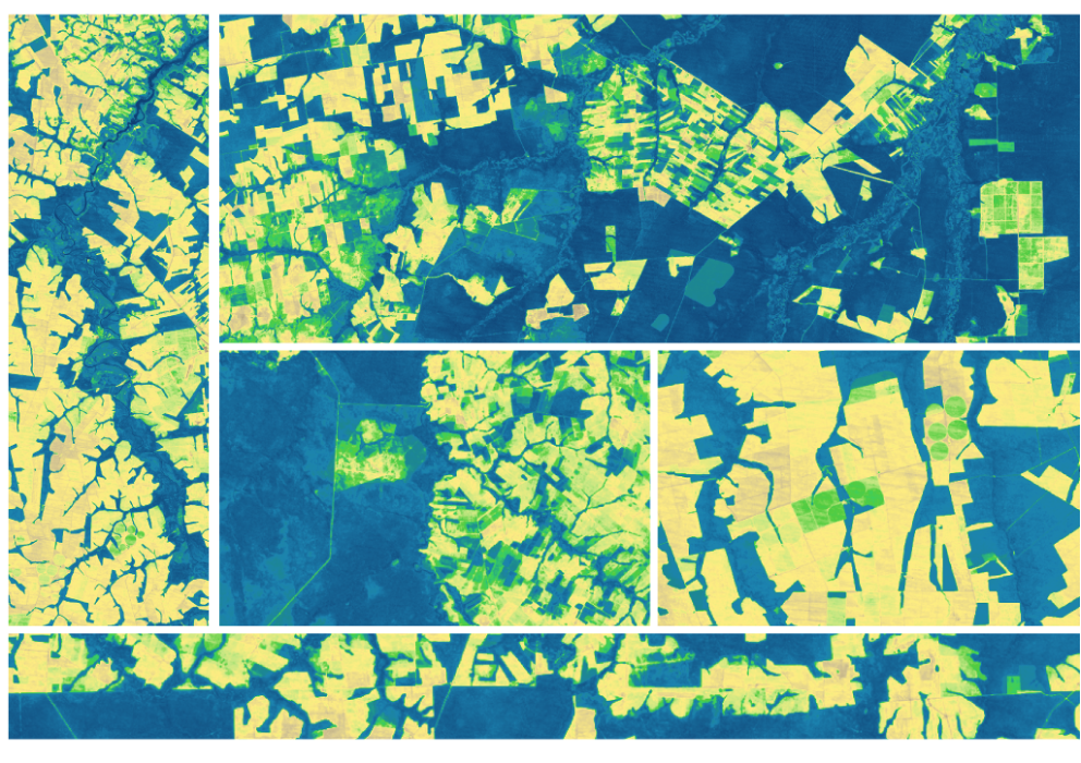
The research teams who help sustain the largest freshwater reserve in the world are developing a new tool to promote more resilient farming systems in Brazil. The goal is to help farmers better handle changes in the water cycle, deal with droughts, and adapt to a changing climate.

Read More »
Landsat Next Defined

Landsat Next Defined

Landsat Next is on the horizon—the new mission will not only ensure continuity of the longest space-based record of Earth’s land surface, it will fundamentally transform the breadth and depth of actionable information freely available to end users. Take a look at the new capabilities that will define the next Landsat mission.

Read More »

Expanding OpenET Across Amazon Basin

The research teams who help sustain the largest freshwater reserve in the world are developing a new tool to promote more resilient farming systems in Brazil. The goal is to help farmers better handle changes in the water cycle, deal with droughts, and adapt to a changing climate.

Read More »

“The Landsat series of satellites is a cornerstone of our Earth observing capability. The world relies on Landsat data to detect and measure land cover/land use change, the health of ecosystems, and water availability.”


“The USGS Landsat Surface Reflectance products have revolutionized human-scale biophysical studies that require consistent and atmospherically corrected products.”


“Landsat and agriculture go hand in hand because agriculture is a seasonal phenomenon, and you really need to monitor it closely over time.”


“Landsat is, on its own merits, an extremely important capability for our country. It becomes all the more important when we overlay on top of that, the challenges of climate change and the fact that we are driving our climate to a place that we haven’t seen before, scientifically.”


“Landsat data gives us a fuller picture of the planet we live on and the resources humanity needs to survive.”


“New sensors are nice, but can’t let us see back in time. Happy 17th!”


“We can really say that we have achieved a level of remote sensing and Earth observation that we have never had before. We’re in the golden age right now with these satellites.”


“The analysis enabled by Landsat heat data provides a foundation for planning and problem solving. Without the data, we’re just guessing about what interventions work best to mitigate hot spots… unraveling the complexity of urban heat will ultimately help us build better cities and improve residents’ quality of life.”


“Nothing is harder to image than the past. It is imperative that all Landsat observations are archived and made available to users.”


“Landsat’s superpower is time travel… With phenology, vegetation phenology, and drought impacts, the time dimension is extremely important and more frequent data allows for higher accuracy and better characterization of agricultural phenomena.”


“When we showed historical Landsat and more recent high resolution images to communities and shared our analysis, people realized what they’d lost over time and wanted to engage in conversations about how to bring the forests back.”


“Over the past 50 years, eight Landsat satellites have circled the planet, which have helped to save and improve lives and support our economy. NASA will continue to work with USGS to improve access to Landsat’s unprecedented 50-year record and build on the program’s legacy.”


“Since the first in the line of Landsat craft entered orbit in 1972, this satellite program has proven valuable to the economy of the United States.”


“With Landsat we can see temperature of individual fields and how it varies from field-to-field. The temperature of the land surface gives us a good indication of how rapidly water is evaporating off that surface. And this is really important for knowing how healthy the crops are and also for supplying information for irrigators: how much water was used last week and how much do they need to replenish in the current week to keep the crops healthy.”


“The analysis enabled by Landsat heat data provides a foundation for planning and problem solving. Without the data, we’re just guessing about what interventions work best to mitigate hot spots… unraveling the complexity of urban heat will ultimately help us build better cities and improve residents’ quality of life.”


“To make accurate machine learning models of major crops, we needed decades of satellite imagery from the entire globe. Thanks to Google Earth Engine hosting the entire Landsat archive publicly on Google Cloud, we can focus on algorithms instead of worrying about collecting petabytes of data. Earth observation will continue to improve with every new satellite launch and so will our ability to forecast global food supply.”


“We would not have been able to complete this research without Landsat’s free and open data policy.”


“A growing archive of Landsat images allow us to see how quickly icesheets are changing.”


“Our mapping techniques build on the historical Landsat record to provide highly needed information on regional scale and this helps in evaluating subtle changes in mangroves over a long period of time (trends) and to detect sudden changes due to natural catastrophes or dramatic anthropogenic impacts… [and] Thanks to the increased abundance of Landsat satellite images, it is becoming progressively easier to collect available images of mangrove habitats captured at low tide and high tide.”


“Having water consumption maps produced quickly on Smartphones has been everyone’s dream. In two years time we hope to see all farmers watching their fields from their phones and scheduling irrigations. EEEFlux is making Landsat the evapotranspiration satellite.”


“We have so many options with Landsat Next, to add additional information and context to support our wetland managers as well as continuing the historical record of change and variability of our wetlands.”


“You can launch a new satellite, but you can’t put something up in the past. Landsat will always be that historic record that new satellites can tie themselves to.”


“The economic value of just one year of Landsat data far exceeds the multi-year total cost of building, launching, and managing Landsat satellites and sensors.”


“From a valuation standpoint, Landsat is an extremely valuable public good just in its direct use—let alone the economic value of all the indirect uses built on the direct data.”


Landsat 9 bw
Landsat 9 bw
Landsat 9 bw

The NASA/USGS Landsat Program provides the longest continuous space-based record of Earth’s land in existence. Landsat data give us information essential for making informed decisions about Earth’s resources and environment.