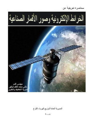
محاضرة تعريفية بالخرائط وصور الأقمار الصناعية - مثنى محمد كاظم
•
1 like•1,167 views

كراس يشرح عن الخرائط الإلكترونية وصور الأقمار الصناعية ومراحل معالجتها من الصورة الخام حتى الصورة النهائية مع شرح عن نظم الإحداثيات والمساقط

Recommended
Recommended
More Related Content
Featured
Featured (20)
محاضرة تعريفية بالخرائط وصور الأقمار الصناعية - مثنى محمد كاظم
- 1. ﻋﻥ ﺘﻌﺭﻴﻔﻴﺔ ﻤﺤﺎﻀﺭﺓ أﻗﺪم ﻣﮭﻨﺪس ﺗﻮﻓﯿﻖ ﻛﺎﻇﻢ ﻣﺤﻤﺪ ﻣﺜﻨﻰ واﻟﺘﻄﻮﯾﺮ اﻟﺘﺨﻄﯿﻂ ﻣﺪﯾﺮﯾﺔ اﻟﻜﺮخ ﻛﮭﺮﺑﺎء ﻟﺘﻮزﯾﻊ اﻟﻌﺎﻣﺔ اﻟﻤﺪﯾﺮﯾﺔ ٢٠٠٨
- 2. إﻋﺪاد اﻟﺼﻨﺎﻋﯿﺔ اﻷﻗﻤﺎر وﺻﻮر اﻹﻟﻜﺘﺮوﻧﯿﺔ اﻟﺨﺮاﺋﻂم.ﻣﺤﻤﺪ ﻣﺜﻨﻰ أﻗﺪمﺗﻮﻓﯿﻖ ﻛﺎﻇﻢ ١ ﺒﺎﻟﺨﺭﺍﺌﻁ ﺘﻌﺭﻴﻔﻴﺔ ﻤﺤﺎﻀﺭﺓﺍﻹﻟﻜﺘﺭﻭﻨﻴﺔﺍﻟﺼﻨﺎﻋﻴﺔ ﺍﻷﻗﻤﺎﺭ ﻭﺼﻭﺭ ﺍﻟﻔﻬﺭﺱ ﺍﻟﻤﻘﺩﻤﺔ ﺍﻷﻭل ﺍﻟﻔﺼل:ﻭﺍﻟﺼﻭﺭ ﺍﻟﺨﺭﺍﺌﻁ ﺒﺄﻨﻭﺍﻉ ﺍﻟﺘﻌﺭﻴﻑ ﺍﻟﺜﺎﻨﻲ ﺍﻟﻔﺼل:ﺒﺼﻭﺭ ﺍﻟﺘﻌﺭﻴﻑRasterﻭﺭﺴﻭﻡVector ﺍﻟﺜﺎﻟﺙ ﺍﻟﻔﺼل:ﺼﻭﺭ ﺘﻜﻭﻴﻥﺍﻟﺼﻨﺎﻋﻴﺔ ﺍﻷﻗﻤﺎﺭﻭﺍﻟﺼﻭﺭﻴﺔ ﺍﻟﻤﻌﺎﻟﺠﺔ ﺍﻟﺍﻟﺭﺍﺒﻊ ﻔﺼل:ﺍﻟﺠﻐﺭﺍﻓﻲ ﺍﻟﻤﺭﺠﻊGeoreferenceﺍﻹﺤﺩﺍﺜﻴﺎﺕ ﻭﻨﻅﻡ ﺍﻟﺨﺎﻤﺱ ﺍﻟﻔﺼل:ﺍﻟﻤﺴﺘﺨﺩﻤﺔ ﺍﻟﺒﺭﺍﻤﺞ ﺍﻟﻤﺼﺎﺩﺭ
- 3. إﻋﺪاد اﻟﺼﻨﺎﻋﯿﺔ اﻷﻗﻤﺎر وﺻﻮر اﻹﻟﻜﺘﺮوﻧﯿﺔ اﻟﺨﺮاﺋﻂم.ﻣﺤﻤﺪ ﻣﺜﻨﻰ أﻗﺪمﺗﻮﻓﯿﻖ ﻛﺎﻇﻢ ٢ ﺍﻟﻤﻘﺩﻤﺔ ﻷﻏﺭﺍﺽ ﻭﺍﻟﻤﻨﺎﻁﻕ ﻭﺍﻟﻤﺩﻥ ﻟﻠﻁﺭﻕ ﺩﻗﻴﻘﺔ ﺨﺭﺍﺌﻁ ﺭﺴﻡ ﺍﻹﻨﺴﺎﻥ ﻭﻴﺤﺎﻭل ﺍﻟﺤﻀﺎﺭﺓ ﻅﻬﻭﺭ ﻤﻨﺫ ﻭ ﻤﺨﺘﻠﻔﺔﻜﺎﻥ ﺇﻥﺍﻟﻌﺴﻜﺭﻱ ﺍﻟﺠﺎﻨﺏﺍﻷﻫﻡ ﻫﻭﻭﻜﺎﻥﻴﺩﻭﻴ ﺒﻁﺭﻕ ﻴﺠﺭﻱ ﺍﻟﺨﺭﺍﺌﻁ ﺭﺴﻡﺒﺩﺍﺌﻴـﺔ ﺔ ﺍﻟﺘﺼﻭﻴﺭ ﺁﻟﺔ ﻭﺇﺨﺘﺭﺍﻉ ﺍﻟﻬﻭﺍﺌﻲ ﺍﻟﻤﻨﻁﺎﺩ ﺇﺨﺘﺭﺍﻉ ﻭﻜﺎﻥ ﹰﺎﺘﺩﺭﻴﺠﻴ ﺍﻟﺨﺭﺍﺌﻁ ﺭﺴﻡ ﺘﻁﻭﺭ ﺍﻟﺯﻤﻥ ﻭﻤﻊ ﻋﺎﻡ ﻤﺭﺘﻔﻊ ﻤﻜﺎﻥ ﻤﻥ ﺍﻷﺭﺽ ﻟﻤﻌﺎﻟﻡ ﺤﻘﻴﻘﻴﺔ ﺼﻭﺭﺓ ﺇﻟﺘﻘﺎﻁ ﺍﻹﻨﺴﺎﻥ ﺇﺴﺘﻁﺎﻉ ﺤﻴﺙ ﻨﻭﻋﻴﺔ ﻁﻔﺭﺓ ١٨٥٥ﻭ ﺘﻭﺭﻨﺎﺸﻭﻥ ﻓﻠﻜﺱ ﺠﻴﺭﺍﺭﺩ ﺍﻟﻔﺭﻨﺴﻲ ﺍﻟﻤﺼﻭﺭ ﻴﺩ ﻋﻠﻰﻫﺫﺍﻤﻔﻬـﻭﻡ ﻅﻬـﻭﺭ ﺇﻟﻰ ﺃﺩﻯ ﺍﻟﺠﻭ ﺍﻟﺼﻭﺭﺓﻭ ﺍﻟﻁﺎﺌﺭﺍﺕ ﻭﺘﻁﻭﺭ ﺍﻟﺘﺼﻭﻴﺭ ﺁﻻﺕ ﺘﻁﻭﺭ ﻤﻊ ﺒﺎﻟﺘﻁﻭﺭ ﻭﺇﺴﺘﻤﺭ ، ﻴﺔﻤﻨﺫﺇﺨﺘﺭﺍﻉ ﺍﻟﺼﻨﺎﻋﻴﺔ ﻭﺍﻷﻗﻤﺎﺭ ﺍﻟﻔﻀﺎﺌﻴﺔ ﺍﻟﻤﺭﻜﺒﺎﺕﻋﺎﻡ١٩٥٧، ﺍﻟـﺼﻨﺎﻋﻴﺔ ﺍﻷﻗﻤﺎﺭ ﺼﻭﺭ ﻤﻔﻬﻭﻡ ﻅﻬﺭ ﻋـﺎﻡ ﺤﺘﻰ ﺒﺎﻟﻤﻅﻼﺕ ﺼﻨﺎﺩﻴﻕ ﻓﻲ ﺘﺴﻘﻁﻬﺎ ﺜﻡ ﺍﻟﺼﻭﺭ ﺘﻠﺘﻘﻁ ﺍﻷﻭﻟﻰ ﺍﻟﺼﻨﺎﻋﻴﺔ ﺍﻷﻗﻤﺎﺭ ﻭﻜﺎﻨﺕ ١٩٧٢ﺍﻟﻘﻤﺭ ﺃﻁﻠﻕ ﺤﻴﺙﺍﻟﺼﻨﺎﻋﻲLandsat-1ﻟﻠﺘـﺼﻭﻴﺭ ﺘﺠﺎﺭﻱ ﺼﻨﺎﻋﻲ ﻗﻤﺭ ﺃﻭل ﻭﻫﻭ ﹰﺎﺇﻟﻜﺘﺭﻭﻨﻴ ﺍﻟﺼﻭﺭ ﺒﺈﺭﺴﺎل ﻭﻴﻘﻭﻡ ﺭﻗﻤﻴﺔ ﺘﺼﻭﻴﺭ ﺃﺠﻬﺯﺓ ﻭﺍﺴﺘﺨﺩﻡﺍﻷﺭﻀﻴﺔ ﺍﻟﻤﺤﻁﺔ ﺇﻟﻰ. ﺜﻡﺍﺴﺘﻤﺭﺕﺃﺠﻴـﺎل ﻭﻅﻬﺭﺕ ﻴﻭﻡ ﺒﻌﺩ ﹰﺎﻴﻭﻤ ﺒﺎﻟﺘﻁﻭﺭLandsat, SPOT and IRS series)( ﺇﺭﺘﻔﺎﻋﻬﺎ ﻴﺒﻠﻎ ﻤﺩﺍﺭﺍﺕ ﺫﺍﺕ ﻭﻫﻲ٧٠٠-٩٠٠ﻓ ﺍﻷﺭﺽ ﺤﻭل ﺩﻭﺭﺘﻬﺎ ﻭﺘﺘﻡ ﻜﻡﻲ١٠٠ﺩﻗﻴﻘﺔ ﺍﻷﻨﻭﺍﻉ ﻅﻬﺭﺕ ﺜﻡ ،)IKONOS،QuickBird(ﺇﺭﺘﻔﺎﻉ ﻴﺒﻠﻎ ﻭﺍﻟﺫﻱﺍﻟﻤﺩﺍﺭﺤـﻭﺍﻟﻲ٦٨٠ ﻜﻡ)ﻟــIKONOS(ﻭﻀـﻭﺡ ﻭﺫﺍﺕ)resolution(ﺃﻋﻠـﻰﻴﺒﻠـﻎ ﻭﺍﻟـﺫﻱ١ﻡ/ﺒﻜـﺴل )ﻟـIKONOS(ﻭﻴﺒﻠﻎ٠,٦ﻡ/ﺒﻜﺴل)ﻟـQuickBird(ﺍﻷﻗﻤـﺎﺭ ﻤﻥ ﺃﺨﺭﻯ ﺃﻨﻭﺍﻉ ﻭﻫﻨﺎﻙ ﻭﺇﺭ ﺃﻜﺒﺭ ﻭﻀﻭﺡ ﺫﺍﺕ ﺍﻟﺼﻨﺎﻋﻴﺔﺘﻔﺎﻉﻴﺒﻠﻎ ﻤﺩﺍﺭﺍﺘﻬﺎ٢٠٠–٣٠٠ﻜﻡ.
- 4. إﻋﺪاد اﻟﺼﻨﺎﻋﯿﺔ اﻷﻗﻤﺎر وﺻﻮر اﻹﻟﻜﺘﺮوﻧﯿﺔ اﻟﺨﺮاﺋﻂم.ﻣﺤﻤﺪ ﻣﺜﻨﻰ أﻗﺪمﺗﻮﻓﯿﻖ ﻛﺎﻇﻢ ٣ ﺍﻷﻭل ﺍﻟﻔﺼل-ﻭﺍﻟﺼﻭﺭ ﺍﻟﺨﺭﺍﺌﻁ ﺒﺄﻨﻭﺍﻉ ﺍﻟﺘﻌﺭﻴﻑ ﻭﺍﺭﺩﺓ ﻤﺼﻁﻠﺤﺎﺕ ﻋﺩﺓ ﻫﻨﺎﻙﺍﻟﻤﻭﻀﻭﻉ ﻫﺫﺍ ﻓﻲﻋﻠﻴﻬﺎ ﺍﻟﺘﻌﺭﻑ ﻴﻨﺒﻐﻲ ﺍﻟﺨﺭﺍﺌﻁ ﻋﻠﻡ)Cartography(:-ﺭﺴﻡ ﻓﻲ ﻴﺒﺤﺙ ﺍﻟﺫﻱ ﺍﻟﻌﻠﻡ ﻭﻫﻭﺍﻟﺨﺭﺍﺌﻁ. ﺍﻟﺨﺭﺍﺌﻁﺍﻟﻴﺩﻭﻴﺔ)maps(:-ﺒ ﺍﻟﻤﺭﺴﻭﻤﺔ ﺍﻟﺨﺭﺍﺌﻁ ﻭﻫﻲﻗﻠﻴﻠﺔ ﻭﻫﻲ ﺍﻟﺒﺴﻴﻁﺔ ﺍﻟﺭﺴﻡ ﻭﺁﻻﺕ ﺎﻟﻴﺩ ﻭﻗﺕ ﺇﻟﻰ ﻭﺘﺤﺘﺎﺝ ﻭﺼﻌﺒﺔ ﺍﻟﺩﻗﺔﻹﻨﺠﺎﺯﻫﺎ ﺃﻁﻭل. ﺍﻹﻟﻜﺘﺭﻭﻨﻴﺔ ﺍﻟﺨﺭﺍﺌﻁ)electronic maps(:-ﺘﺴﻤﻰ ﻭﻜﺫﻟﻙﺍﻟﺭﻗﻤﻴـﺔ ﺍﻟﺨـﺭﺍﺌﻁ)digital maps(ﻭﻫﻲﻭ ﺭﺴﻡﻤﻌﺎﻟﻡ ﺘﺸﻜﻴلﺍﻹﻟﻜﺘﺭﻭﻨﻴـﺔ ﺍﻟﺭﺴـﻡ ﻭﺃﺠﻬـﺯﺓ ﺒـﺎﻟﻜﻭﻤﺒﻴﻭﺘﺭ ﺍﻟﺨـﺭﺍﺌﻁ )ﺃﻭ ﻟﻴﺯﺭﻱ ﺜﻴﻭﺩﻭﻻﻴﺕﺘﺴﺠ ﺃﺠﻬﺯﺓﻤﻊ ﻤﻌﻠﻭﻤﺎﺕ ﻴلGPS(ﺒﺤﻔـﻅ ﺘﺘـﻴﺢ ﺼﻴﻐﺔﺍﻟﻤﻌﻠﻭﻤـﺎﺕ ﹰﺎﺭﻗﻤﻴﻭﻁﺒﺎﻋﺘﻬﺎ ﻭﻋﺭﻀﻬﺎ ﻭﻤﻌﺎﻟﺠﺘﻬﺎﺒﺩﻗﺔﻭ ﻋﺎﻟﻴﺔﺒﺴﻬﻭﻟﺔ ﺘﺤﺩﻴﺜﻬﺎ ﻴﻤﻜﻥ.ﺘﺸﻜﻴل ﻤﺎﻴﺘﻡ ﹰﺎﻭﻏﺎﻟﺒ ﻤﻨﻬﺎ ﻜل ﻁﺒﻘﺎﺕ ﻋﺩﺓ ﻤﻥ ﺍﻟﺨﺭﺍﺌﻁ ﻫﺫﻩﻋﻠﻴﻬﺎ ﻤﺭﺴﻭﻤﺔﻤﻌﺎﻟﻤﻌﻴﻨﺔ ﻡ،ﺍﻟﻁﺒﻘـﺔ ﺘﻜﻭﻥ ﺃﻥ ﻭﻴﻤﻜﻥ ﺼﻨﺎﻋﻲ ﻗﻤﺭ ﺼﻭﺭﺓ ﺍﻷﻭﻟﻰﻤﺭﺴﻭﻤﺔ ﺍﻷﺨﺭﻯ ﻭﺍﻟﻁﺒﻘﺎﺕﺒﺎﻟﻜﻭﻤﺒﻴﻭﺘﺭ. ﺍﻟﺠﻭﻴﺔ ﺍﻟﺼﻭﺭ)sgraphAerial photo(:-ﺍﻟﻁـﺎﺌﺭﺍﺕ ﺒﻭﺍﺴـﻁﺔ ﺍﻟﻤﻠﺘﻘﻁﺔ ﺍﻟﺼﻭﺭ ﻭﻫﻲ ﻟﻤﺴﺎﺤﺔﻤﺤﺩﻭﺩﺓﹰﺍﺠﺩ ﻭﻗﻠﻴﻠﺔ ﺍﻷﺭﺽ ﻤﻥﻭﺨﺼﻭﺼﻭﻋﻨـﺩ ﺍﻟﻌـﺴﻜﺭﻴﺔ ﺍﻹﺴـﺘﺨﺩﺍﻤﺎﺕ ﻓـﻲ ﹰﺎ ﺍﻟﻜﻭﺍﺭﺙﻷﻥ ﻭﺫﻟﻙﻭﻭﻀﻊ ﺍﻟﺼﻭﺭﺓ ﺘﺼﺤﻴﺢﻟﻺﺤـﺩﺍﺜﻴﺎﺕ ﺼـﺤﻴﺢ ﻨﻅﺎﻡ ﺃﻱ ﺠﻐﺭﺍﻓﻲ ﻤﺭﺠﻊ ﹰﺔﻨﺴﺒ ﻤﻜﻠﻔﺔ ﻋﻤﻠﻴﺔﺍﻟﻤﺴ ﺇﻟﻰﺎﺤﺔ. ﺍﻟﺼﻨﺎﻋﻴﺔ ﺍﻷﻗﻤﺎﺭ ﺼﻭﺭ)Satellite images(:-ﺍﻷﻗﻤـﺎﺭ ﺒﻭﺍﺴﻁﺔ ﺍﻟﻤﻠﺘﻘﻁﺔ ﺍﻟﺼﻭﺭ ﻭﻫﻲ ﺼـﺤﻴﺢ ﺇﺤﺩﺍﺜﻴﺎﺕ ﻭﻨﻅﺎﻡ ﺠﻐﺭﺍﻓﻲ ﻤﺭﺠﻊ ﻟﻬﺎ ﺍﻟﺼﻭﺭ ﻭﻫﺫﻩ ﺒﺎﻟﺘﺼﻭﻴﺭ ﺍﻟﻤﺘﺨﺼﺼﺔ ﺍﻟﺼﻨﺎﻋﻴﺔ ﹰﺎﺼﻭﺭﻴ ﻭﻤﻌﺎﻟﺠﺔﻟﺘﺼﺤﻴﺢﺍﻟﺼﻭﺭﺓ ﻤﻌﺎﻟﻡ ﻭﺘﻔﺴﻴﺭ ﺍﻷﺨﻁﺎﺀ ﺒﻌﺽ،ﺒﺘﺴﻤﻴﺔ ﺸﺎﺌﻊ ﺨﻁﺄ ﻭﻫﻨﺎﻙ ﺍﻟﺼﻨﺎﻋﻴﺔ ﺍﻷﻗﻤﺎﺭ ﺼﻭﺭﺍﻟﺠﻭﻴﺔ ﺒﺎﻟﺼﻭﺭ. ﻟﻠﺘﺼﻭﻴﺭ ﻭﻗﺕ ﻭﺃﻓﻀل)ﺍﻹﻀﺎﺀﺓ ﺤﻴﺙ ﻤﻥ(ﺍﻟـﺴﺎﻋﺔ ﺒـﻴﻥ ﻫـﻭ٩:٣٠-١٠:٣٠ﹰﺎﺼـﺒﺎﺤ ﺘﺼﻭﻴﺭﻫﺎ ﺍﻟﻤﺭﺍﺩ ﻟﻠﻤﻨﻁﻘﺔ ﺍﻟﻤﺤﻠﻲ ﺒﺎﻟﺘﻭﻗﻴﺕ. ﺠﻐﺭﺍﻓﻴﺔ ﺒﻴﺎﻨﺎﺕ ﻗﺎﻋﺩﺓ)GeoDatabase(:-ﻭﺍﻟﺒﻴﺎﻨـﺎﺕ ﺍﻟﻤﻌﻠﻭﻤـﺎﺕ ﻤﻥ ﻜﻡ ﻋﻥ ﻋﺒﺎﺭﺓ ﻫﻲ ﻋﻥ ﺍﻟﻤﺼﺎﺩﺭ ﻤﺘﻨﻭﻋﺔ ﻭﺍﻟﺠﻐﺭﺍﻓﻴﺔ ﺍﻟﺭﻗﻤﻴﺔﻭﺃﻨﺸﻁﺔ ﻤﻌﺎﻟﻡﻤﻭﺍﻗﻊ ﺫﺍﺕﻭﻜـﺫﻟﻙ ﻤﺨﺘﻠﻔﺔ ﺠﻐﺭﺍﻓﻴﺔ ﺒﻴﻨﻬﺎ ﻓﻴﻤﺎ ﺍﻟﻌﻼﻗﺔ.ﻋﻠﻰ ﺍﻟﺒﻴﺎﻨﺎﺕ ﻗـﻭﺍﻋـﺩ ﻭﺘﺤﺘﻭﻱﺠﺩﺍﻭلﻤﺅﻟﻔﺔﺴﺠﻼﺕ ﻤﻥ)Records( ﺍﻟﺤﻘـﻭل ﻤﻥ ﻤﺠﻤﻭﻋﺔ ﻋﻠﻰ ﻴﺤﺘﻭﻱ ﺴﺠـل ﻜل)Fields(ﻤﻌﻴﻨـﺔ ﺨـﺼﺎﺌﺹ ﻭﻓـﻕ ﻤﺒﻨﻴﺔ
- 5. إﻋﺪاد اﻟﺼﻨﺎﻋﯿﺔ اﻷﻗﻤﺎر وﺻﻮر اﻹﻟﻜﺘﺮوﻧﯿﺔ اﻟﺨﺮاﺋﻂم.ﻣﺤﻤﺪ ﻣﺜﻨﻰ أﻗﺪمﺗﻮﻓﯿﻖ ﻛﺎﻇﻢ ٤ )Attributes(ﺍﻟﻨﺘـﺎﺌﺞ ﻭﺭﺒـﻁ ﻭﻋﺭﻀـﻬﺎ ﻭﺘﺤﻠﻴﻠﻬـﺎ ﻭﺘﻔـﺴﻴﺭﻫـﺎ ﺘﺨﺯﻴﻨﻬﺎ ﻟﺘﺴﻬﻴل ﻭﺫﻟﻙ ﺒﺎﻟﻤﻌﺍﻟﺒﻴﺎﻨﺎﺕ ﻗﺎﻋﺩﺓ ﻓﻲ ﺘﺨﺯﻴﻨﻬﺎ ﺘﻡ ﺍﻟﺘﻲ ﻠﻭﻤﺎﺕ.ﻭﻓـﻲ ﺍﻟﺒﻴﺎﻨـﺎﺕ ﻗﺎﻋـﺩﺓ ﺒﻨﺎﺀ ﻤﺭﺤﻠﺔ ﺘﻌﺘﺒﺭ ﺍﻟﻌـﻤل ﺃﻫـﺩﺍﻑ ﺘﺤﻘـﻕ ﺍﻟﺘﻲ ﺍﻟﻤﺭﺍﺤل ﺃﻫـﻡ ﻤﻥ ﺍﻟﺠﻐﺭﺍﻓﻴﺔ ﺍﻟﻤﻌﻠﻭﻤﺎﺕ ﻨﻅﻡ ﻤﺸﺎﺭﻴﻊ. ﺍﻟﺘﺭﻗﻴﻡ:ﻋﻠـﻰ ﻗﺭﺍﺀﺘﻬـﺎ ﻟﻴﻤﻜﻥ ﺍﻟﺭﻗﻤﻴﺔ ﺍﻟﻬﻴﺌﺔ ﺇﻟﻰ ﻤﻁﺒﻭﻋﺔ ﻭﺭﻗﻴﺔ ﺨﺭﻴﻁﺔ ﺘﺤﻭﻴل ﻋﻤﻠﻴﺔ ﻫﻭ ﺍﻟﻜﻭﻤﺒﻴﻭﺘﺭﺒﺈﺩﺨﺎ ﻭﺫﻟﻙ ،ﺒﺈﺴﺘﺨﺩﺍﻡ ﺍﻟﺠﻐﺭﺍﻓﻴﺔ ﻟﻠﻤﻌﺎﻟﻡ ﺍﻟﺠﻐﺭﺍﻓﻴﺔ ﺍﻹﺤﺩﺍﺜﻴﺎﺕ لﻜﻭﻤﺒﻴﻭﺘﺭ ﺒﺭﺍﻤﺞ ﺨﺎﺼﺔ. ﺍﻟﺠﻐﺭﺍﻓﻴﺔ ﺍﻟﻤﻌﻠﻭﻤﺎﺕ ﻨﻅﺎﻡ)Geographic Information System-GIS(:-ﻭﻫﻭﻨﻅﺎﻡ ﺍﻟﻤﻜﺎﻨﻴﺔ ﺍﻟﻁﺒﻴﻌﺔ ﺫﺍﺕ ﺍﻟﺒﻴﺎﻨﺎﺕ ﻭﺘﺤﻠﻴل ﻭﻤﻌﺎﻟﺠﺔ ﻭﺇﺩﺍﺭﺓ ﻟﺠﻤﻊ ﺤﺎﺴﻭﺒﻲ)spatial(.ﻘـﺼﺩﻴﻭ ﻤﻜﺎﻨﻴﺔ ﺒﻜﻠﻤﺔ)spatial(ﺃﻥﻤﻌﺎﻟﻡ ﺍﻟﺒﻴﺎﻨﺎﺕ ﻫﺫﻩ ﺘﺼﻑ)features(ﺴـﻁﺢ ﻋﻠـﻰ ﺠﻐﺭﺍﻓﻴـﺔ ﺍﻷﺭﺽﺀﺴﻭﺍ ،ﻭﺍﻟﻁﺭﻕ ﻜﺎﻟﻤﺒﺎﻨﻲ ﺍﺼﻁﻨﺎﻋﻴﺔ ﺃﻡ ﻭﺍﻷﻨﻬﺎﺭ ﻜﺎﻟﻐﺎﺒﺎﺕ ﻁﺒﻴﻌﻴﺔ ﺍﻟﻤﻌﺎﻟﻡ ﻫﺫﻩ ﺃﻜﺎﻨﺕ ﻭﺍﻟﺴﺩﻭﺩ ﻭﺍﻟﺠﺴﻭﺭﺍﻟﻤﺎﺀ ﻭﺸﺒﻜﺎﺕ ﺍﻟﻜﻬﺭﺒﺎﺌﻴﺔ ﻭﺍﻟﺸﺒﻜﺎﺕﺍﻟﻌﺴﻜﺭﻴﺔ ﻭﺍﻷﻫﺩﺍﻑﻭﻏﻴﺭﻫﺎ. ﺃﻭﻋﻠﻰ ﺘﺤﺘﻭﻱ ﺍﻟﻤﻌﻠﻭﻤﺎﺕ ﻨﻅﺎﻡ ﻤﻥ ﺨﺎﺼﺔ ﺤﺎﻟﺔ ﻫﻭﺍﻟﺘﻭﺯﻴﻊ ﺩﺭﺍﺴﺔ ﻋﻠﻰ ﺘﻌﺘﻤﺩ ﺒﻴﺎﻨﺎﺕ ﻗﻭﺍﻋﺩ ﺍﻟﻨﻘـﺎﻁ ﻤﺜـل ﺍﻟﻤﻜﺎﻨﻲ ﺍﻟﻤﺤﻴﻁ ﻓﻲ ﺘﺤﺩﻴﺩﻫﺎ ﻴﻤﻜﻥ ﺍﻟﺘﻲ ﻭﺍﻷﻫﺩﺍﻑ ﻭﺍﻷﻨﺸﻁﺔ ﻟﻠﻅﻭﺍﻫﺭ ﺍﻟﻤﻜﺎﻨﻲ ﻭﺍﻟﻤﺴﺎﺤﺎﺕ ﻭﺍﻟﺨﻁﻭﻁﺒﺘﻠﻙ ﺍﻟﻤﺭﺘﺒﻁﺔ ﺍﻟﺒﻴﺎﻨﺎﺕ ﺒﻤﻌﺎﻟﺠﺔ ﺍﻟﺠﻐﺭﺍﻓﻴﺔ ﺍﻟﻤﻌﻠﻭﻤﺎﺕ ﻨﻅﺎﻡ ﻴﻘﻭﻡ ﺤﻴﺙ ، ﺃﻭ ﺍﻟﻨﻘﺎﻁﺠﺎﻫﺯﺓ ﺍﻟﺒﻴﺎﻨﺎﺕ ﻟﺠﻌل ﺍﻟﻤﺴﺎﺤﺎﺕ ﺃﻭ ﺍﻟﺨﻁﻭﻁﻹﺴﺘﺃﻭ ﺘﺤﻠﻴﻠﻬـﺎ ﺃﺠـل ﻤـﻥ ﺭﺠﺎﻋﻬﺎ ﺨﻼﻟﻬﺎ ﻤﻥ ﺒﻴﺎﻨﺎﺕ ﻋﻥ ﺍﻻﺴﺘﻌﻼﻡ. ﻤﺴﺘﺨﺩﻤﺔ ﺍﻟﻨﻅﺎﻡ ﻫﺫﺍ ﺘﻘﻨﻴﺎﺕ ﺒﻌﺽ ﻜﺎﻨﺕ ﻟﻘﺩﻜﺭﻭﺯ ﺼﻭﺍﺭﻴﺦ ﺘﻭﺠﻴﻪ ﻤﺠﺎل ﻓﻲ)ﺘﺤﻤـل ﻭﺍﻟﺘﻲ ﺍﻟﺼﺎﺭﻭﺥ ﻓﻲ ﺍﻟﻤﺨﺯﻨﺔ ﺍﻟﺼﻭﺭﺓ ﻤﻊ ﺍﻟﻬﺩﻑ ﺃﺭﺽ ﻟﻤﻘﺎﺭﻨﺔ ﺘﺼﻭﻴﺭ ﻜﺎﻤﻴﺭﺍ(ﺍﻟﺜﻤﺎﻨﻴﻨﻴـﺎﺕ ﻓـﻲ ﺍﻟﺘﺴﻌﻴﻨﺎﺕ ﻭﺒﺩﺍﻴﺔﻨﻬﺎﻴﺔ ﻓﻲ ﻋﻨﻬﺎ ﺍﻹﺴﺘﻐﻨﺎﺀ ﺘﻡ ﺜﻡﺘﻘﻨﻴـﺎﺕ ﻋﻠﻰ ﺍﻟﺼﻭﺍﺭﻴﺦ ﻭﺇﻋﺘﻤﺎﺩ ﺍﻟﺘﺴﻌﻴﻨﺎﺕ ﺍﻟـGPS. ﺍﻟﻤﺠﺎل ﻫﺫﺍ ﻓﻲ ﺍﻟﻤﺘﺨﺼﺼﺔ ﺍﻟﺒﺭﺍﻤﺞ ﺃﻫﻡ ﻭﻤﻥ)ArcGIS(ﻭ)CYME(ﻓﻲ ﻤﺘﺨﺼﺹ ﻭﻫﻭ ﻭ ﺍﻟﻜﻬﺭﺒﺎﺌﻴﺔ ﺍﻟﺸﺒﻜﺎﺕﻜﺫﻟﻙﺒﺭﻨﺎﻤﺞ)AutoCAD(ﻴﻤﻜﻥﻓﻴﻪﺒﻴﺎﻨﺎﺕ ﻗﻭﺍﻋﺩ ﺇﻨﺸﺎﺀﻤﺒﺴﻁﺔ.
- 6. إﻋﺪاد اﻟﺼﻨﺎﻋﯿﺔ اﻷﻗﻤﺎر وﺻﻮر اﻹﻟﻜﺘﺮوﻧﯿﺔ اﻟﺨﺮاﺋﻂم.ﻣﺤﻤﺪ ﻣﺜﻨﻰ أﻗﺪمﺗﻮﻓﯿﻖ ﻛﺎﻇﻢ ٥ ﺃﺏﺠ ﺒﻐﺩﺍﺩ ﻟﻤﺩﻴﻨﺔ ﺒﺎﻟﻜﻭﻤﺒﻴﻭﺘﺭ ﻤﺭﺴﻭﻤﺔ ﺇﻟﻜﺘﺭﻭﻨﻴﺔ ﺨﺎﺭﻁﺔ ﺘﻤﺜل ﺃ ﺍﻟﺼﻭﺭﺓ ﻤﺭﺴﻭﻤﺔ ﺇﻟﻜﺘﺭﻭﻨﻴﺔ ﺨﺎﺭﻁﺔ ﺘﻤﺜل ﺏ ﺍﻟﺼﻭﺭﺓﻁﺒﻘﺎﺕ ﺸﻜل ﻋﻠﻰﺒﺎﻟﻜﻭﻤﺒﻴﻭﺘﺭﺼﻨﺎﻋﻲ ﻗﻤﺭ ﺼﻭﺭﺓ ﻋﻠﻰﺒﻐﺩﺍﺩ ﻟﻤﺩﻴﻨﺔ ﺍﻟﺼﻭﺭﺓﺠﺒﻐﺩﺍﺩ ﻟﻤﺩﻴﻨﺔ ﺼﻨﺎﻋﻲ ﻗﻤﺭ ﺼﻭﺭﺓ ﺘﻤﺜل
- 7. إﻋﺪاد اﻟﺼﻨﺎﻋﯿﺔ اﻷﻗﻤﺎر وﺻﻮر اﻹﻟﻜﺘﺮوﻧﯿﺔ اﻟﺨﺮاﺋﻂم.ﻣﺤﻤﺪ ﻣﺜﻨﻰ أﻗﺪمﺗﻮﻓﯿﻖ ﻛﺎﻇﻢ ٦ ﺍﻟﺜﺎﻨﻲ ﺍﻟﻔﺼل-ﺒﺼﻭﺭ ﺍﻟﺘﻌﺭﻴﻑRasterﻭﺭﺴﻭﻡVector ﺍﻷﺸﻜﺎل ﺘﻨﻘﺴﻡﺍﻟﻜﻭﻤﺒﻴﻭﺘﺭ ﺒﺭﺍﻤﺞ ﻓﻲﻨﻭﻋﻴﻥ ﺇﻟﻰ: ImagesRaster:-ﺃﻱﺍﻟﺼﻭﺭﺍﻟﻨﻘﻁﻴﺔ،ﹰﺎﺃﻴﻀ ﻭﺘﺴﻤﻰImagesBitmap،ﻤـﻥ ﻭﺘﺘﻜﻭﻥ ﺍﻟﺼﻐﻴﺭﺓ ﺍﻟﻤﺭﺒﻌﺎﺕ ﻤﻥ ﺸﺒﻜﺔﺘﺴﻤﻰPixels,ﻤﺭﺒﻊ ﻭﻜلﺜﺎﺒﺕ ﻤﻜﺎﻥ ﻟﻪ ﻴﻜﻭﻥﺜﺎﺒـﺕ ﻭﻟـﻭﻥ ﻭﺩﺭﺠﺔﺴﻁﻭﻉﺍﻹﺠﻤﺎﻟ ﺍﻟﻌﺩﺩ ﺃﻥ ﻜﻤﺎ ﺜﺎﺒﺘﺔﻲﻟﻠﹰﺎﺜﺎﺒﺘ ﻴﻜﻭﻥ ﻤﺭﺒﻌﺎﺕﺍﻟـﺼﻭﺭﺓ ﻤﻠﻑ ﻓﻲ ﻭﻴﺨﺯﻥ ، ﺍﻟﺴﻁﻭﻉ ﻭﺩﺭﺠﺔ ﺍﻟﻠﻭﻥ ﻤﻊ ﺍﻟﻤﺭﺒﻊ ﻋﻨﻭﺍﻥﺤﺠﻡ ﺘﻐﻴﻴﺭ ﻋﻨﺩ ﻭﻟﺫﻟﻙﺍﻟﺼﻭﺭﺓﻴﻔﻘﺩ ﻓﺈﻨﻪ ﺒﺎﻟﺘﻜﺒﻴﺭ ﻭﺩﻗﺘﻪ ﻭﻀﻭﺤﻪ ﻤﻥ ﻜﺒﻴﺭﺍ ﺠﺯﺀﺍ،ﻫﺫﺍﺘﻔـﺎﻭﺕ ﻤـﻥ ﻤﻘﺒﻭﻟـﺔ ﺩﺭﺠﺔ ﻴﻅﻬﺭ ﺍﻟﺼﻭﺭ ﻤﻥ ﺍﻟﻨﻭﻉ ﻭﺍﻟﻅﻼل ﺍﻷﻟﻭﺍﻥ،ﺍﻟﻘﺴﻡ ﻫﺫﺍ ﺘﺤﺕ ﻴﻨﺩﺭﺝ ﻭﺍﻟﻔﻭﺘﻭﻏﺭﺍﻓﻴﺔ ﺍﻟﺼﻭﺭ–ﺍﻷﻗﻤـﺎﺭ ﺼـﻭﺭ ﻭﻤﻨﻬﺎ ﺍﻟﺠﻭﻴﺔ ﻭﺍﻟﺼﻭﺭ ﺍﻟﺼﻨﺎﻋﻴﺔ–ﺍﻟﺘ ﺒﺒﺭﺍﻤﺞ ﺍﻟﻤﻨﺘﺠﺔ ﻭﺍﻟﺘﺼﺎﻤﻴﻡﻌﺎﻤلﺍﻟﺼﻭﺭ ﻤﻊ. Vector Graphics:-ﺃﻱﺍﻟﺭﺴﻭﻤﺎﺕﺍﻟﻤﺘﺠﻬﺔ،ﺭﺘﻌـ ﻭﻤﻨﺤﻨﻴـﺎﺕ ﺨﻁـﻭﻁ ﻤﻥ ﻭﺘﺘﻜﻭﻥﻑ ﺭﻴﺎﻀﻴﺔ ﺒﺼﻴﻎﻭﺘﺴﻤﻰﺍﻟﻤﺘﺠﻬﺎﺕ(Vectors)ﺃﻱﺍﻟﺼﻭﺭﺓ ﺍﻟﻤﺘﺠﻬﺎﺕ ﺘﺼﻑﺍﻟﻤﺭﺴﻭﻤﺔﹰﺎﻭﻓﻘـ ﻷﺭﻗﺎﻡﺭﻴﺎﻀﻴﺔ ﻭﺼﻴﻎﻫﻨﺩﺴﻴﺔﻤﺜلﻭ ﺍﻟﻨﻘﻁﺔﺍﻟﻤﺴﺘﻘﻴﻡﺍﻷﻀـﻼﻉ ﺍﻟﻤﺘﻌﺩﺩﺓ ﻭﺍﻷﺸﻜﺎلﻭﺍﻟـﺩﺍﺌﺭﺓ ﻭﺍﻟﻘﻭﺱ.ﻓ ﺇﻅﻬﺎﺭﻫﺎ ﻴﻤﻜﻥ ﺍﻟﻤﺘﺠﻬﺎﺕ ﻭﺭﺴﻭﻤﺎﺕﻲﺃﻱﺃﻥ ﺩﻭﻥ ﺍﻟﺘﻜﺒﻴـﺭ ﺃﻭ ﺒﺎﻟﺘـﺼﻐﻴﺭ ﺤﺠﻡ ﻴﺅﺜﺭﻭﻀﻭﺤﻬﺎ ﻭﺩﺭﺠﺔ ﺠﻭﺩﺘﻬﺎ ﻋﻠﻰ ﺫﻟﻙﺃﻱﺍﻟـresolution،ﺍﻟﻘـﺴﻡ ﻫـﺫﺍ ﺘﺤﺕ ﻭﻴﻨﺩﺭﺝ ﻭ ﺍﻹﻟﻜﺘﺭﻭﻨﻴﺔ ﺍﻟﺨﺭﺍﺌﻁﺍﻟﻤﻨﺘﺠﺔ ﻭﺍﻟﺘﺼﺎﻤﻴﻡ ﺍﻟﺭﺴﻭﻡﺒﺒـﻤﺜـل ﺍﻟﺭﺴـﻡ ﺭﺍﻤﺞCorel Draw , AutoCAD Macromedia Flash , GIS. ﻤﺒﺴﻁ ﺸﻜلﻴﺒﻴﻥﺍﻟﻨﻭﻋﻴﻥ ﺒﻴﻥ ﺍﻟﻔﺭﻕ
- 8. إﻋﺪاد اﻟﺼﻨﺎﻋﯿﺔ اﻷﻗﻤﺎر وﺻﻮر اﻹﻟﻜﺘﺮوﻧﯿﺔ اﻟﺨﺮاﺋﻂم.ﻣﺤﻤﺪ ﻣﺜﻨﻰ أﻗﺪمﺗﻮﻓﯿﻖ ﻛﺎﻇﻢ ٧ ﺼﻭﺭﺓ ﻴﺒﻴﻥ ﺸﻜلﺼﻨﺎﻋﻲ ﻗﻤﺭ)Raster(ﻋﻠﻴﻬﺎ ﻤﺭﺴﻭﻡ)Vector(ﻴﻘل ﺍﻟﺘﻜﺒﻴﺭ ﻭﻋﻨﺩ ﺍﻷﺤﻤﺭ ﺒﺎﻟﻠﻭﻥ ﺍﻟـ ﺍﻟﺼﻭﺭﺓ ﻭﻀﻭﺡRasterﺍﻟـ ﺭﺴﻡ ﻴﺒﻘﻰ ﺒﻴﻨﻤﺎVectorﺒﻨﻔﺱﺍﻟﻭﻀﻭﺡ ﺩﺭﺠﺔ ﺍﻟـResolution:ﺃﻭ ﺍﻟﻨﻘﺎﻁ ﻋﺩﺩ ﻫﻭpixelsﻓﻲﻓ ﺍﻟﻤﺴﺘﺨﺩﻤﺔ ﺍﻟﻘﻴﺎﺱ ﻭﺤﺩﺓﻲﺍﻟﻌﻤل ﺇﻨﺘﺎﺝ ،ﺒـﺼﻴﻐﺔ ﻋﻨﻪ ﺍﻟﺘﻌﺒﻴﺭ ﻓﻴﺘﻡ ﻟﻠﺼﻭﺭ ﻭﺒﺎﻟﻨﺴﺒﺔ(ppi=pixels per inch)ﻷﺠﻬـﺯﺓ ﻭﺒﺎﻟﻨـﺴﺒﺔ ﺍﺴﺘﺨﺩﺍﻡ ﻓﻴﺘﻡ ﻭﺍﻟﻁﺎﺒﻌﺎﺕ ﺍﻟﻌﺭﺽ( dpi =dots per inch) ,،ﺍﻟﻘﻴﻤﺔ ﻜﺎﻨﺕ ﻭﻜﻠﻤﺎﻜﻠﻤ ﻋﺎﻟﻴﺔﺎ ﻴﻌﻨ ﺫﻟﻙ ﻜﺎﻥﻲﺃﻜﺜﺭ ﺘﻔﺎﺼﻴلﻭﺘﺩﺭﻴﺠﺎﺕﺃﻨﻌﻡ ﻟﻭﻨﻴﺔﻭﺒﺎﻟﺘﺎﻟﻲﻋﺎﻟﻴﺔ ﺠﻭﺩﺓ،ﺼـﺤﻴﺢ ﻭﺍﻟﻌﻜﺱ، ﺍﻟﺸﻜل ﻓﻲ ﻭﻜﻤﺎﺃﺩﻨﺎﻩ ﺍﻟﻭﻀﻭﺡ ﺩﺭﺠﺔ ﻴﺒﻴﻥ ﺸﻜل-resolution-ﻗﻴﻤﺔ ﻟﻜلppiﻭﺍﺤﺩﺓ ﻟﺼﻭﺭﺓ
- 9. إﻋﺪاد اﻟﺼﻨﺎﻋﯿﺔ اﻷﻗﻤﺎر وﺻﻮر اﻹﻟﻜﺘﺮوﻧﯿﺔ اﻟﺨﺮاﺋﻂم.ﻣﺤﻤﺪ ﻣﺜﻨﻰ أﻗﺪمﺗﻮﻓﯿﻖ ﻛﺎﻇﻢ ٨ ﻓﻭﻕ ﺍﻟﺼﻭﺭﺓ ﺒﺘﻤﺜﻴل ﻴﻘﻭﻡ ﺍﻟﻌﺭﺽ ﺠﻬﺎﺯ ﻜﺎﻥ ﻭﻟﻤﺎﻓ ﻏﺎﻴﺔ ﺸﺒﻜﺔﻲﺍﻟﻨﻭﻋﻴﻥ ﻤﻥ ﻜﻼ ﻓﺈﻥ ﺍﻟﺩﻗﺔ ﻋﺭﻀ ﻴﺘﻡﻤﻥ ﻤﺠﻤﻭﻋﺔ ﺸﻜل ﻋﻠﻰ ﻬﻤﺎﺍﻟـpixels. ﺍﻷﻭل ﻟﻠﻨﻭﻉ ﺍﻟﻌﺭﺽ ﺠﻭﺩﺓ ﻭﺘﻌﺘﻤﺩ)Raster(ﻜـﺎﺭﺕ ﻓﻴﻪ ﺒﻤﺎ ﺍﻟﻤﺴﺘﺨﺩﻡ ﺍﻟﻌﺭﺽ ﺠﻬﺎﺯ ﻋﻠﻰ ﺍﻟﺸﺎﺸـﺔ،ﺇﻟﻰ ﺒﺎﻹﻀﺎﻓﺔﺍﻟـResolutionﺍﻷﺼﻠﻲﺃ ﺒﺤﻴﺙﻱﻭﻀـﻭﺡ ﻤﻥ ﻴﻐﻴﺭ ﻓﻴﻪ ﺘﻐﻴﻴﺭ ﺍﻟﺼﻭﺭﺓ،ﺠ ﺃﻤﺎـﺍﻟﺜﺎﻨ ﺍﻟﻨﻭﻉ ﻋﺭﺽ ﻭﺩﺓﻲ(Vector)ﻓ ﺍﻟﻌﺭﺽ ﺠﻬﺎﺯ ﻋﻠﻰ ﻓﺘﻌﺘﻤﺩﻭﻻ ﻘـﻁ ﺘﺘﺄﺜﺭﺍﻟ ﺒﺘﻐﻴﻴﺭ ﺠﻭﺩﺘﻪـResolution.ﻭﻓﻲﻭﺼ ﺍﻟﺠﻭﻴﺔ ﺍﻟﺼﻭﺭـﺍﻟـﺼﻨﺎﻋﻴﺔ ﺍﻷﻗﻤـﺎﺭ ﻭﺭ ﻴﻘﺎﺱﺍﻟـResolution)ﹰﺎﺃﺤﻴﺎﻨ ﻭﻴﺴﻤﻰ( spatial resolutionﺒﻭﺤﺩﺓmeters/pixelﺃﻱ ﻤﺭﺒﻊ ﻀﻠﻊ ﻁﻭلﺍﻟـpixelﺩﻗﺔ ﺃﻜﺜﺭ ﻜﺎﻥ ﺃﺼﻐﺭ ﻜﺎﻥ ﻭﻜﻠﻤﺎ ﺍﻟﻭﺍﺤﺩﺍﻟﻭﺍﻀـﺤﺔ ﻭﺍﻟﺨﺎﺭﻁـﺔ ﺘﻜﻭﻥ ﻟﻠﻤﺩﻴﻨﺔﺒﺤﺩﻭﺩ١meters/pixelﺃﻗل ﺃﻭ)ﺃﻱﺍﻟـpixelﺒﻘﻴـﺎﺱ ﺍﻟﻭﺍﺤـﺩ١ﻡ×١ﻡ ﻋﻨﺼﺭ ﻭﺃﺼﻐﺭﻁﻭﻟﻪ ﺍﻟﺼﻭﺭﺓ ﻓﻲ ﻴﻅﻬﺭ١ﻡ(. ﺍﻟـ ﺼﻭﺭ ﺃﻨﻭﺍﻉRaster ﻟ ﻋﺩﺓ ﻁﺭﻕ ﻭﻫﻨﺎﻙﻭ ﺘﺸﻜﻴلﺍﻟﻬﻴﺌﺔ ﺃﻭ ﺒﺎﻟﻨﺴﻕ ﻴﻌﺭﻑ ﻭﻤﺎ ﺍﻟﺼﻭﺭ ﻓﻲ ﺍﻟﺒﻴﺎﻨﺎﺕ ﻀﻐﻁFormat ﺍﻟﺼﻭﺭ ﺍﻟﻰ ﺒﺎﻟﻨﺴﺒﺔ ﺒﻬﺎ ﺨﺎﺼﺔ ﻁﺭﻴﻘﺔ ﺘﺼﻤﻡ ﻫﻴﺌﺔ ﺃﻭ ﺸﺭﻜﺔ ﻓﻜل.ﻭﻴﻋﻠـﻰ ﺍﻟﺘﻌـﺭﻑ ﻤﻜـﻥ ﻭ ﺍﻟﻤﻴﺯﺍﺕﺍﻟﻔﺭﻭﺍﻟ ﻫﻴﺌﺔ ﺒﻴﻥ ﻕـGIFﻭJPGﻭPSDﻭBMPﻭTIFFﻭSIDﻭPNG ﻭECW.ﻤﻥ ﻭﻏﻴﺭﻫﺎﺍ ﺃﻨﻭﺍﻉﻟﺼﻭﺭ.ﻫﻨﺎﻙﻨﻭﻋﺎﻥﻭﻫﻤـﺎ ﺒﻜﺜﺭﺓ ﻭﻤﻨﺘﺸﺭﺍﻥ ﻤﻌﺭﻭﻓﺎﻥGIF ﻭJPEGﻭﻴﻤﻜﻥﻭﻴﺴﺭ ﺒﺴﻬﻭﻟﺔﻓﺘﺢﻭﻤﺸﺎﻫﺩﺓﻫﺫﻴﻥ ﺒﺄﺤﺩ ﺘﻜﻭﻥ ﺍﻟﺘﻲ ﺍﻟﺼﻭﺭﺍﻟﻨﻭﻋﻴﻥﻭﻜﻤـﺎ ﺫﻜﺭﻨﺎﻤﻥ ﻨﺴﻕ ﻜل ﻓﺎﻥ ،ﺍﻟﻨ ﻫﺫﻴﻥﻭﻋﻴﻥﺍﻟﺘـﻲ ﺍﻟﻤﺴﺎﺤﺔ ﺘﻘﻠﻴﺹ ﺒﻬﺩﻑ ﻓﻴﻪ ﺍﻟﺒﻴﺎﻨﺎﺕ ﻀﻐﻁ ﻴﺘﻡ ﻭﻟﻜﻥ ،ﺍﻟﻜﻤﺒﻴﻭﺘﺭ ﺫﺍﻜﺭﺓ ﻓﻲ ﻴﺤﺘﻼﻨﻬﺎﺍﻟﻨﻭﻉJPEGﻤـﻥ ﺃﻜﺜـﺭ ﺍﻟﻠﻭﻥ ﻤﻌﻠﻭﻤﺎﺕ ﻋﻠﻰ ﻴﺤﺘﻭﻱ GIFﺍﻟﺭﻤـﺎﺩﻱ ﺍﻟﻠـﻭﻨﻴﻥ ﻅﻼل ﺃﻭ ﺍﻟﻠﻭﻥ ﻓﻴﻬﺎ ﻴﻜﻭﻥ ﺍﻟﺘﻲ ﻟﻠﺼﻭﺭ ﻋﺎﺩﺓ ﻴﺴﺘﺨﺩﻡ ،ﺍﻟﺴﺒﺏ ﻭﻟﻬﺫﺍ ﻜﺒﻴﺭﺓ ﺃﻫﻤﻴﺔ ﺫﺍﺕ ﻭﺍﻷﺴﻭﺩ. ﺇﻥﺍﻟﻨﻭﻉGIFﻴﺤﻤﻥ ﺃﻗل ﺒﺎﻟﻠﻭﻥ ﺨﺎﺼﺔ ﻤﻌﻠﻭﻤﺎﺕ ﻋﻠﻰ ﺘﻭﻱﺍﻟﻨـﻭﻉJPEGﺃﻓـﻀل ﻭﻟﻜﻨـﻪ ﺍﻟـﺼﻐﻴﺭﺓ ﻭﺍﻟـﺸﻌﺎﺭﺍﺕ ﺍﻟﻨـﺼﻭﺹ ﻓﻲ ﺒﻜﺜﺭﺓ ﻴﺴﺘﺨﺩﻡ ﺍﻟﺴﺒﺏ ﻭﻟﻬﺫﺍ ﺍﻟﺤﺎﺩﺓ ﺍﻟﺨﻁﻭﻁ ﻟﻌﺭﺽ ﻭﺍﻷﻴﻜﻭﺍﻟﺨﻁﻭﻁ ﻭﺍﻷﺯﺭﺍﺭ ﻭﻨﺎﺕ،ﺍﻟﻤﻤﻜﻥ ﻤﻥ ﺃﻨﻪ ﻜﻤﺎﺇﻋﺩﺍﺩﺍﻟﺤﺭﻜـﺔ ﺼـﻭﺭAnimation ﺒﺎﻟﻨﻭﻉGIFﻻ ﻤﺎ ﻭﻫﻭﺒﻭﺍﺴﻁﺔ ﺍﻨﺠﺎﺯﻩ ﻴﻤﻜﻥJPEGﻭﺍﻟﻨﻭﻉ ،PNGﺍﻟﻨﻭﻉ ﻴﺸﺎﺒﻪGIF.
- 10. إﻋﺪاد اﻟﺼﻨﺎﻋﯿﺔ اﻷﻗﻤﺎر وﺻﻮر اﻹﻟﻜﺘﺮوﻧﯿﺔ اﻟﺨﺮاﺋﻂم.ﻣﺤﻤﺪ ﻣﺜﻨﻰ أﻗﺪمﺗﻮﻓﯿﻖ ﻛﺎﻇﻢ ٩ ﺃﻨ ﻭﻫﻨﺎﻙﻭﺍﻉﻤﻨﻬﺎ ﻟﻠﺼﻭﺭ ﺃﺨﺭﻯﺍﻟﻨﻭﻉBMPﻭﻨﺩﻭﺯ ﻓﻲ ﻤﺴﺘﺨﺩﻤﺔ ﻤﻠﻔﺎﺕ ﻫﻲ ﺍﻟﺼﻭﺭ ﻭﻫﺫﻩ ﻀـﻐﻁ ﻤـﻥ ﺍﺨﺘﺯﺍﻨﻬـﺎ ﺍﻟﻤﻤﻜـﻥ ﻤـﻥ ﻷﻨـﻪ ،ﻜﺒﻴـﺭﺓ ﻤﻠﻔﺎﺕ ﺍﻟﻌﺎﺩﺓ ﻓﻲ ﻭﻫﻲﺍﻟﺒﻴﺎﻨـﺎﺕ· ﻭﺍﻟﻨﻭﻉPSDﻤﻠﻔﺎﺕ ﻭﻫﻲﺃﺩﻭﺒﻲﺃﺩﻭﺒﻲ ﺸﺭﻜﺔ ﻁﻭﺭﺘﻬﺎ ﻓﻭﺘﻭﺸﻭﺏ. ﻭﻫﻨﺎﻙﺍﻟﻨﻭﻉTIFFﻟﺘﺒﺎ ﻋﺎﺩﺓ ﻭﻴﺴﺘﺨﺩﻡﺍﻟﻜﻤﺒﻴﻭﺘﺭ ﻭﺃﺠﻬﺯﺓ ﺍﻟﺒﺭﺍﻤﺞ ﺃﻨﻭﺍﻉ ﺒﻴﻥ ﺍﻟﺼﻭﺭ ﺩلﻭﻓﻲ ﺍﻟﺼﻨﺎﻋﻴﺔ ﺍﻷﻗﻤﺎﺭ ﺼﻭﺭﺍﻟﺒﻴﺎﻨﺎﺕ ﻤﻥ ﻫﺎﺌل ﻜﻡ ﺤﻤل ﻴﻤﻜﻨﻪ ﺤﻴﺙﺍﻟﺼﻭﺭﺓ ﻤﻠﻑ ﺤﺠﻡ ﻴﺼل ﻭﻗﺩ ﺒﻀﻌﺔ ﺇﻟﻰGBytesﺍﻹﺤﺩﺍﺜﻲ ﺍﻟﻨﻅﺎﻡ ﻴﺨﺯﻥ ﺃﻥ ﺍﻟﻨﻭﻉ ﻟﻬﺫﺍ ﻭﻴﻤﻜﻥﻭﻟـﻴﺱ ﺍﻟﺼﻭﺭﺓ ﻤﻠﻑ ﻓﻲ ﻤﻨﻔﺼل ﻤﻠﻑ ﻓﻲﻴﺴﻤﻰ ٍﺫﻭﻋﻨﺩﺌGeoTIFF· ﻭﹰﺎﺃﻴﻀﺍﻟﻨﻭﻉSID)ﺸﺭﻜﺔ ﻁﻭﺭﺘﻪLizardTech(ﺍﻟﺤﺠـﻡ ﺫﺍﺕ ﺍﻟـﺼﻭﺭ ﻟﻀﻐﻁ ﻭﻴﺴﺘﺨﺩﻡ ﹰﺍﺠﺩ ﺍﻟﻜﺒﻴﺭﻭﺤﺘﻰﺇﻟﻰ٢٠%ﺍﻟﺤﻘﻴﻘﻲ ﺤﺠﻤﻬﺎ ﻤﻥﹰﺍﺠﺩ ﻋﺎﻟﻴﺔ ﻭﺒﺠﻭﺩﺓﻜﻤﺎﻓﻲﻀـﻐﻁﺼـﻭﺭ ﻤﻌﻬﺎ ﺍﻟﺘﻌﺎﻤل ﻴﺴﻬل ﻜﻲ ﺃﺼﻐﺭ ﺤﺠﻡ ﺇﻟﻰ ﺍﻟﺼﻨﺎﻋﻴﺔ ﺍﻷﻗﻤﺎﺭ،ﺍﻟﺘـﻲ ﻫـﻲ ﻤﺤـﺩﻭﺩﺓ ﻭﺒﺭﺍﻤﺞ ﺍﻟﺠﻐﺭﺍﻓﻴﺔ ﺍﻟﺒﺭﺍﻤﺞ ﹰﺎﻭﺨﺼﻭﺼ ﺍﻟﺼﻭﺭ ﻤﻥ ﺍﻟﻨﻭﻉ ﻫﺫﺍ ﻤﻊ ﺘﺘﻌﺎﻤلﺍﻷﻗﻤﺎﺭ ﺼﻭﺭ ﻤﻊ ﺘﺘﻌﺎﻤل ﺍﻟﺘﻲ ﺍﻟﺼﻨﺎﻋﻴﺔﺒﺭﻨﺎﻤﺞ ﻭﺤﺘﻰ ،AutoCADﻻﺒﺘﻨـﺼﻴﺏ ﹼﻻﺇ ﺍﻟـﺼﻭﺭ ﻤﻥ ﺍﻟﻨﻭﻉ ﻫﺫﺍ ﻤﻊ ﻴﺘﻌﺎﻤل ﻫﻭ ﻤﻌﻪ ﺁﺨﺭ ﺒﺭﻨﺎﻤﺞAutodesk raster design. ﻭﺍﻟﻨﻭﻉECWﻤﺨﺘﺼﺭ ﻭﻫﻭEnhanced Compression Wavelet)ﺸـﺭﻜﺔ ﻁﻭﺭﺘـﻪ Earth Resource Mapping(ﺍﻟﺼ ﻭﻀﻐﻁ ﻟﻠﺘﻌﺎﻤل ﻭﻴﺴﺘﺨﺩﻡﺍﻟﺤﺠﻡ ﺍﻟﻔﺎﺌﻘﺔ ﻭﺭ)ﻓـﻲ ﻜﻤﺎ ﺍﻟﺼﻨﺎﻋﻴﺔ ﺍﻷﻗﻤﺎﺭ ﺼﻭﺭ ﻀﻐﻁ(ﺇﻟﻰ ﺘﺼل ﻭﺍﻟﺘﻲ50 000 Gb. ﻨ ﻤﺎﺌﺔ ﻤﻥ ﺃﻜﺜﺭ ﻭﻫﻨﺎﻙﻭﻉﻟﻠـﺼﻭﺭ،ﻤﺨﺘﻠﻔـﺔ ﻫﻴﺌـﺎﺕ ﺃﻭ ﺸـﺭﻜﺎﺕ ﻨﺘـﺎﺝ ﻤـﻥ ﻭﻫـﻲ. ﻤﻬﻤﺔ ﻤﻼﺤﻅﺔ:-ﺍﻟﺼﻨﺎﻋﻴﺔ ﺍﻷﻗﻤﺎﺭ ﻭﺼﻭﺭ ﺍﻹﻟﻜﺘﺭﻭﻨﻴﺔ ﺍﻟﺨﺭﺍﺌﻁ ﻟﻤﻠﻔﺎﺕ ﺍﻟﻜﺒﻴﺭ ﺍﻟﺤﺠﻡ ﺒﺴﺒﺏ ﺍﻟﺼﻭﺭﺓ ﻜل ﻋﺭﺽ ﻴﻤﻜﻥ ﻻ ﻭﺒﺎﻟﺘﺎﻟﻲ، ﹰﺍﺠﺩ ﺒﻁﺊ ﻭﺍﻟﺘﻌﺎﻤل ﺍﻟﺘﺤﻤﻴل ﻴﻜﻭﻥ ﺃﻭﺒـﺭﺍﻤﺞ ﺘﻌﺘﻤـﺩ ﺒﺎﻟﻬﺭﻤﻲ ﻴﻌﺭﻑ ﻋﺭﺽ ﺇﺴﻠﻭﺏ ﺍﻟﻤﺘﺨﺼﺼﺔ ﺍﻟﻜﻭﻤﺒﻴﻭﺘﺭ)Pyramids(ﻴﻘـﻭﻡ ﺃﻱﺍﻟﺒﺭﻨـﺎﻤﺞ ﻟﻠﻌﺭﺽ ﻤﺴﺘﻭﻴﺎﺕ ﺒﺘﺤﺩﻴﺩﻴﻘﻭﻡ ﻤﺴﺘﻭﻯ ﻜل ﻭﻓﻲﺃﺠﺯﺍﺀ ﺒﺘﺤﻤﻴلﻓﻘﻁ ﺍﻟﺼﻭﺭﺓ ﻤﻥﻜـل ﻭﻟﻴﺱ ﺍﻟﺼﻭﺭﺓ)ﻤﺘﺠﺎﻭﺭﺓ ﺒﻜﺴﻼﺕ ﻤﺠﻤﻭﻋﺔ ﻤﻥ ﻭﺍﺤﺩﺓ ﺒﻜﺴل(ﻋﺭﺽ ﻤﻨﻅﺭ ﻟﻜل)Zoom(ﻭﺤﻴﻨﻬﺎ ﺃﻜﺜﺭ ﺍﻟﺘﻘﺭﻴﺏ ﻭﻋﻨﺩ ﺍﻟﺩﻗﻴﻘﺔ ﺍﻟﺘﻔﺎﺼﻴل ﻀﻤﻥ ﻷﻨﻪ ﺍﻟﺨﻠل ﻤﻼﺤﻅﺔ ﺍﻟﻌﻴﻥ ﺘﺴﺘﻁﻴﻊ ﻻﺍﻟﺘﺤـﻭل ﺃﻱ ﺁﺨﺭ ﻋﺭﺽ ﻤﺴﺘﻭﻯ ﺇﻟﻰﻓـﻲ ﺨﻠـل ﺤﺼﻭل ﻟﺘﻼﻓﻲ ﺇﻀﺎﻓﻴﺔ ﺒﻜﺴﻼﺕ ﺒﺘﺤﻤﻴل ﺍﻟﺒﺭﻨﺎﻤﺞ ﻴﻘﻭﻡ ﺃﻱ ﺍﻟﺘﻔﺎﺼﻴل ﻭﺘﺯﺩﺍﺩ ﺍﻟﻤﻌﺭﻭﻀﺔ ﺍﻟﺼﻭﺭﺓ ﻤﺴﺎﺤﺔ ﺘﻘل ﺃﻜﺜﺭ ﺘﻘﺭﺏ ﻭﻜﻠﻤﺎ ، ﺍﻟﻤﻌﺭﻭﻀﺔ ﺍﻟﺼﻭﺭﺓ ﺍﻟﺒﻜﺴﻼﺕ ﻋﺩﺩﺍﻟﻤﺴﺎﺤﺔ ﻟﻭﺤﺩﺓ.
- 11. إﻋﺪاد اﻟﺼﻨﺎﻋﯿﺔ اﻷﻗﻤﺎر وﺻﻮر اﻹﻟﻜﺘﺮوﻧﯿﺔ اﻟﺨﺮاﺋﻂم.ﻣﺤﻤﺪ ﻣﺜﻨﻰ أﻗﺪمﺗﻮﻓﯿﻖ ﻛﺎﻇﻢ ١٠ ﺍﻟﺜﺎﻟﺙ ﺍﻟﻔﺼل:ﺍﻟﺼﻭﺭﻴﺔ ﻭﺍﻟﻤﻌﺎﻟﺠﺔ ﺍﻟﺼﻨﺎﻋﻴﺔ ﺍﻷﻗﻤﺎﺭ ﺼﻭﺭ ﺘﻜﻭﻴﻥ ﺍﻟﺼﻭﺭﻴﺔ ﺍﻟﻤﻌﺎﻟﺠﺔ-mage processingI:-ﺒﻴﺎﻨﺎﺘﻬﺎ ﻭﺘﻔﺴﻴﺭ ﺒﺎﻟﺼﻭﺭ ﺍﻟﺘﻼﻋﺏ ﺃﻭ ﺍﻟﺘﻌﺎﻤل ، ﺍﻟﻜﻭﻤﺒﻴﻭﺘﺭ ﺒﺈﺴﺘﺨﺩﺍﻡ ﺍﻟﺘﺸﻭﻫﺎﺕ ﻭﺘﺼﺤﻴﺢﺍﻟﻤﻌﺎ ﻭﺘﺘﻀﻤﻥﻭﺃﻋﻤـﺎل ﺨﻁـﻭﺍﺕ ﺍﻟﺼﻭﺭﻴﺔ ﻟﺠﺔ ﻤﺘﺨﺼﺼﺔ ﺒﺭﺍﻤﺞ ﺒﻭﺍﺴﻁﺔ ﻤﺘﻘﺩﻤﺔ ﻭﺭﻴﺎﻀﻴﺔ ﻓﻴﺯﻴﺎﺌﻴﺔ ﻁﺭﻕ ﺘﺴﺘﺨﺩﻡ ﻜﺜﻴﺭﺓ. ﺍﻟﺠﻭﻴﺔ ﻭﺍﻟﺼﻭﺭ ﺍﻟﺼﻨﺎﻋﻴﺔ ﺍﻷﻗﻤﺎﺭ ﻟﺼﻭﺭ ﺍﻟﺼﻭﺭﻴﺔ ﺍﻟﻤﻌﺎﻟﺠﺔ ﺃﻫﺩﺍﻑ ﻭﺃﻫﻡ:- ﹰﻻﺃﻭ-ﺍﻟﺘـﺸﻭﻴﺵ ﺇﺯﺍﻟـﺔ)noise(ﻭﻀـﺒﻁﺍﻟـﺼﻭﺭﺓﺍﻟﻌﻤﻠﻴـﺔ ﻫـﺫﻩ ﻭﺘـﺴﻤﻰImage Enhancement:-ﺍﻷﻗ ﺼﻭﺭ ﺘﺤﺘﻭﻱ ﹰﺎﻏﺎﻟﺒﺍﻟﺼﻨﺎﻋﻴﺔ ﻤﺎﺭﻭﻟﻜﻨﻬﺎ ﺃﻫﻤﻴﺔ ﺫﺍﺕ ﻤﻌﺎﻟﻡ ﻋﻠﻰ ﺍﻟـﺴﻁﻭﻉ ﺸﺩﺓ ﺤﻴﺙ ﻤﻥ ﻭﺍﻀﺤﺔ ﻏﻴﺭ(brightness)ﻭﺍﻟﺘﻤـﺎﻴﺯ)contrast(ﻭﺍﻟﻠـﻭﻥ )color(ﺍﻟﻅل ﺒﺴﺒﺏ،ﺴﻘﻭﻁ ﻭﺯﺍﻭﻴﺔﻭﺍﻨﻌﻜﺎﺱﺍﻟﻀﻭﺀ،ﺍﻟﻠﻭﻨﻲ ﻭﺍﻟﺘﻘﺎﺭﺏ،ﻭﺍﻟﺘـﺸﻭﻴﺵ )noise(ﺍﻟﺤﺎﺼلﻓﻲﺃﺠﻬﺯﺓﺃﻭ ﺍﻟﺘﺼﻭﻴﺭﻷﺒﻴﺌﻴﺔ ﺴﺒﺎﺏ،ﻭﻏﻴﺭﻫﺎﻟﺫﻟﻙ ﻭﻨﺘﻴﺠﺔﻴـﺼﻌﺏ ﺘﻔﺎﺼﻴﻠﻬﺎ ﻭﻓﻬﻡ ﺘﻔﺴﻴﺭﻫﺎﺍﻟﺜﻼﺜﺔ ﺍﻟﻌﻭﺍﻤل ﻫﺫﻩ ﻀﺒﻁ ﻴﺘﻡ ﻟﺫﺍﻭﺍﻀﺤﺔ ﺘﻔﺎﺼﻴل ﻋﻠﻰ ﻟﻠﺤﺼﻭل ﻴﻠﻲ ﻭﻜﻤﺎ. ﻴﺒﻴﻥ ﺸﻜلﻋﺩﻡﻭﻀﻭﺡﻏﺎﻤﻘﺔ ﻭﻅﻬﻭﺭﻫﺎ ﺍﻟﺼﻭﺭﺓ ﻤﻥ ﺃﺠﺯﺍﺀﺒﺴﺒﺏﺴﻘﻭﻁ ﺯﺍﻭﻴﺔﻭﺍﻨﻌﻜﺎﺱﺍﻟﻀﻭﺀ
- 12. إﻋﺪاد اﻟﺼﻨﺎﻋﯿﺔ اﻷﻗﻤﺎر وﺻﻮر اﻹﻟﻜﺘﺮوﻧﯿﺔ اﻟﺨﺮاﺋﻂم.ﻣﺤﻤﺪ ﻣﺜﻨﻰ أﻗﺪمﺗﻮﻓﯿﻖ ﻛﺎﻇﻢ ١١ ﻴﺒﻴﻥ ﺸﻜلﺍﻟﺘﺸﻭﻴﺵ ﻅﻬﻭﺭﺍﻟﺘﺼﻭﻴﺭ ﺃﺠﻬﺯﺓ ﻓﻲ ﺍﻟﺤﺎﺼلﺃﺸﺭﻁﺔ ﺸﻜل ﻋﻠﻰ ﻓﺸـﺩﺓﺤﺩﺓ ﻋﻠﻰ ﺒﻜﺴل ﻟﻜل ﻀﺒﻁﻬﺎ ﻴﺘﻡ ﺍﻟﺴﻁﻭﻉ. ﻀﺒﻁﻪ ﻴﺘﻡ ﻭﺍﻟﺘﻤﺎﻴﺯﻟﻠﺼﻭﺭﺓﺘﻘﻨﻴﺎﺕ ﺒﻌﺩﺓﺃﻫﻤﻬﺎ:- – Thresholding , ﺒﻜﺴل ﻜل ﻀﺒﻁ ﻴﺘﻡ ﺍﻟﻠﻭﻥ ﻟﻤﺴﺘﻭﻴﺎﺕ ﻋﺘﺒﺔ ﺘﺤﺩﻴﺩ ﻋﻠﻰ ﻭﺘﻌﺘﻤﺩﻭﻓﻘﻬﺎ. – Stretching , ﻤﻭﻗﻌﻬﺎ ﺒﺤﺴﺎﺏ ﺒﻜﺴل ﻜل ﻋﻠﻰ ﺘﻁﺒﻴﻘﻬﺎ ﻴﺘﻡ ﺭﻴﺎﻀﻴﺔ ﻤﻌﺎﺩﻟﺔ ﻋﻠﻰ ﻭﺘﻌﺘﻤﺩﺍﻟﺼﻭﺭﺓ ﻓﻲ. – Slicing , ﻭﺘﻋﻠﻰ ﻌﺘﻤﺩﺍﻟﻤﻭﺯﻋﺔ ﺍﻟﻠﻭﻥ ﻤﺴﺘﻭﻴﺎﺕ ﺘﻘﺴﻴﻡﺍﻟﺼﻭﺭﺓ ﻋﻠﻰﺇﻟﻰ ﺍﻟﺒﻴﺎﻨﻲ ﺍﻟﺭﺴﻡ ﻭﻓﻕﻤـﺴﺘﻭﻴﺎﺕ ﻟﻭﻨﻴﺔﻤﺤﺩﺩﺓ)ﺸﺭﺍﺌﺢ-Slices(. ﻫﺫﻩ ﻟﺤﺩﻭﺩ ﻤﻤﻴﺯﺓ ﻟﻭﻨﻴﺔ ﻤﺴﺘﻭﻴﺎﺕ ﺒﺈﻋﻁﺎﺀ ﺍﻟﻤﻬﻤﺔ ﺍﻟﺼﻭﺭﺓ ﻤﻌﺎﻟﻡ ﺒﻌﺽ ﺘﻤﺎﻴﺯ ﻀﺒﻁ ﻴﺘﻡ ﹰﺎﻭﺃﻴﻀ ﺤﻭﻟﻬﺎ ﺍﻟﺘﻲ ﺍﻟﺒﻜﺴﻼﺕ ﻋﻥ ﺘﺘﻤﺎﻴﺯ ﺒﺤﻴﺙ ﺍﻟﻤﻌﺎﻟﻡﺍﻟﻌﻤﻠﻴﺔ ﻫﺫﻩ ﻭﺘﺴﻤﻰEdge enhancement. ﺃﻤﺎﻓﻴﺘﻡ ﺍﻟﻠﻭﻥﺨﻼل ﻤﻥ ﺘﺤﺩﻴﺩﻩﺩﻤﺞﺍﻟﻤﺘﻌﺩﺩﺓ ﺍﻟﺼﻭﺭ ﻤﻥ ﺼﻭﺭﺓ ﻜل ﺃﻟﻭﺍﻥﺍﻟﺼﻭﺭﺓ ﺇﻥ ﺤﻴﺙ ﺘﺩﻤﺞ ﺼﻭﺭ ﻋﺩﺓ ﻤﻥ ﺘﺘﺄﻟﻑ ﺍﻟﻭﺍﺤﺩﺓﹰﺔﺴﻭﻴ. ﻁﺭ ﻭﻫﻨﺎﻙﻴﻘﺔﻤﻌﻘﺩﺓ ﺃﺨﺭﻯﺘﺴﻤﻰSpatial filteringﻋﻠﻰ ﺘﻌﺘﻤﺩﺍﻟﺘﺨﻠﺹﺍﻟﺘﻘﻠﻴـل ﺃﻭﻤـﻥ ﺍﻟﺘﺭﺩﺩﺍﺕﻟﻠﺘﺸﻭﻴﺵ ﺍﻟﻤﺴﺒﺒﺔ)ﺍﻟﻌﺎﻟﻴﺔ ﹰﺎﻭﺨﺼﻭﺼ(ﺒﺈﺴﺘﺨﺩﺍﻡﺃﺴﺎﻟﻴﺏﻤﺘﻘﺩﻤـﺔ ﺭﻴﺎﻀـﻴﺔﻤﺜـل Fourier،Wavelet.
- 13. إﻋﺪاد اﻟﺼﻨﺎﻋﯿﺔ اﻷﻗﻤﺎر وﺻﻮر اﻹﻟﻜﺘﺮوﻧﯿﺔ اﻟﺨﺮاﺋﻂم.ﻣﺤﻤﺪ ﻣﺜﻨﻰ أﻗﺪمﺗﻮﻓﯿﻖ ﻛﺎﻇﻢ ١٢ ﹰﺎﺜﺎﻨﻴ-ﻭﺘﺸﻤل ﺍﻟﻬﻨﺩﺴﻴﺔ ﺍﻟﺘﺼﺤﻴﺤﺎﺕ:- ١-ﺘﺼﺤﻴﺢﺒﺴﺒﺏ ﺍﻟﻨﻅﺭ ﺯﺍﻭﻴﺔﺍﻷﺭﻀﻴﺔ ﺍﻟﻜﺭﺓ ﺇﻨﺤﻨﺎﺀﺍﻟﻌﻤﻭﺩﻱ ﺍﻟﻭﻀﻊ ﺇﻟﻰ،ﻫـﺫﻩ ﻭﺘﺴﻤﻰ ﺍﻟﻌﻤﻠﻴﺔOrthorectification:-ﺍﻟﺘﺼﻭﻴﺭ ﺯﺍﻭﻴﺔ ﻤﻴﻼﻥ ﻭﻜﺫﻟﻙ ﺍﻷﺭﺽ ﻜﺭﻭﻴﺔ ﺒﺴﺒﺏﻭﻫﺫﺍ ﺜﺎ ﻟﻴﺱ ﺍﻟﻤﻴﻼﻥﺒﻜـل ﻭﺘـﺯﺩﺍﺩ ﺍﻟﺘﺼﻭﻴﺭ ﺠﻬﺎﺯ ﺘﺤﺕ ﺍﻟﺘﻲ ﻟﻠﻨﻘﻁﺔ ﺒﺎﻟﻨﺴﺒﺔ ﻤﻭﺠﻭﺩ ﻏﻴﺭ ﻓﻬﻭ ﺒﺕ ﺒﻬﺎ ﺨﺎﺼﺔ ﻤﻴﻼﻥ ﺯﺍﻭﻴﺔ ﺒﻜﺴل ﻟﻜل ﺴﻴﻜﻭﻥ ﺃﻱ ﺍﻹﺒﺘﻌﺎﺩ ﻤﻊ ﺍﻹﺘﺠﺎﻫﺎﺕ–ﻟﺫﺍﺒﻜل ﺍﻟﻤﻴﻼﻥ ﻴﺯﺩﺍﺩ ﺍﻟﻤﺴﺎﺤﺔ ﺇﺘﺴﺎﻉ ﻤﻊ ﺍﻹﺘﺠﺎﻫﺎﺕ–ﻴﻅﻬﺭ ﻭﺒﺎﻟﻨﺘﻴﺠﺔﺴﻁﺢﺍﻟﺼﻭﺭﺓﺍﻟﻨﻅـﺭ ﺯﺍﻭﻴﺔ ﺃﻱ ﺃﻓﻘﻲ ﻏﻴﺭ ﺍﻹﺘﺠﺎ ﺘﻜﻭﻥ ﻭﺒﺫﻟﻙ ﻋﻤﻭﺩﻴﺔ ﻏﻴﺭﻨﻅﺎﻡ ﻭﻀﻊ ﻴﻤﻜﻥ ﻭﻻ ﺼﺤﻴﺤﺔ ﻏﻴﺭ ﻭﺍﻟﺯﻭﺍﻴﺎ ﻭﺍﻟﻤﺴﺎﻓﺎﺕ ﻫﺎﺕ ﺍﻟﺨﻁﺄ ﻫﺫﺍ ﺘﺼﺤﻴﺢ ﻴﺘﻡ ﻟﺫﻟﻙ ﻟﻠﺼﻭﺭﺓ ﺼﺤﻴﺢ ﺇﺤﺩﺍﺜﻴﺎﺕ. ﺍﻟﻤﺸﻜﻠﺔ ﻭﺘﺯﺩﺍﺩﺍﻟﺼﻭﺭﺓ ﻓﻲ ﻋﺎﻟﻴﺔ ﺇﺭﺘﻔﺎﻋﺎﺕ ﺫﺍﺕ ﺃﺠﺴﺎﻡ ﻭﺠﻭﺩ ﻋﻨﺩ)ﺃﻭ ﻋﺎﻟﻴﺔ ﺒﻨﺎﻴﺎﺕ ﺃﻭ ﺠﺒﺎل ﺃﺒﺭﺍﺝ(ﺍﻷﺒﻌﺎﺩ ﺜﻼﺜﻲ ﻤﻨﻅﻭﺭ ﺒﺸﻜل ﺴﺘﻅﻬﺭ ﻓﺈﻨﻬﺎ،ﺤـﺴﺎ ﻓـﻲ ﺘﺘﺭﻜـﻪ ﺍﻟﺫﻱ ﺍﻟﻅل ﻭﻴﻔﻴﺩﺒﺎﺕ ﺍﻹﺭﺘﻔﺎﻉ ﻭﻗﻴﺎﺱ ﺍﻟﺼﻭﺭﺓ ﺘﺼﺤﻴﺢ.ﻭﻓﻲﺍﻟﺘﻀﺎﺭﻴﺱﺍﻟﻌﺎﻟﻴﺔﻭﺍﻟﻤﺭﺘﻔﻌﺎﺕﻴﺘﻡﺍﻟﺼﻭﺭﺓ ﺘﺼﺤﻴﺢ ﻭﻫـﺫ ﺒﺎﻹﺭﺘﻔﺎﻉ ﺍﻟﺨﺎﺼﺔ ﺍﻟﻤﻌﻠﻭﻤﺎﺕ ﻭﺘﺨﺯﻥ ﺍﻟﻌﻤﻭﺩﻱ ﺍﻟﻭﻀﻊ ﺇﻟﻰﺘ ﺍﻟﺨﻁـﻭﺓ ﻩﺒــ ﻌـﺭﻑ (DEM)digital elevation model. ﺇﻨﺤﻨﺎﺀ ﻴﺒﻴﻥ ﺸﻜلﺴﻁﺢﺍﻷﺭﻀﻴﺔ ﺍﻟﻜﺭﺓﻭﺍﻟﺘﺼﻭﻴﺭ ﺯﺍﻭﻴﺔ ﻤﻴﻼﻥ
- 14. إﻋﺪاد اﻟﺼﻨﺎﻋﯿﺔ اﻷﻗﻤﺎر وﺻﻮر اﻹﻟﻜﺘﺮوﻧﯿﺔ اﻟﺨﺮاﺋﻂم.ﻣﺤﻤﺪ ﻣﺜﻨﻰ أﻗﺪمﺗﻮﻓﯿﻖ ﻛﺎﻇﻢ ١٣ ﺍﻟﺘﺼﺤﻴﺢ ﺒﻌﺩﺍﻟﺘﺼﺤﻴﺢ ﻗﺒل ﻴﺒﻴﻥ ﺸﻜلﺍﻟﻌﻤﻭﺩﻱ ﺍﻟﻭﻀﻊ ﺇﻟﻰ ﺍﻷﺭﻀﻴﺔ ﺍﻟﻜﺭﺓ ﺇﻨﺤﻨﺎﺀ ﺒﺴﺒﺏ ﺍﻟﻨﻅﺭ ﺯﺍﻭﻴﺔ ﺘﺼﺤﻴﺢ ﻴﺒﻴﻥ ﺸﻜلﺒ ﺘﻅﻬﺭ ﻭﺍﻟﺘﻲ ﺍﻟﻌﺎﻟﻴﺔ ﺍﻹﺭﺘﻔﺎﻋﺎﺕ ﺫﺍﺕ ﺍﻷﺠﺴﺎﻡﻋﻤﻭﺩﻴﺔ ﻏﻴﺭ ﻨﻅﺭ ﺯﺍﻭﻴﺔ
- 15. إﻋﺪاد اﻟﺼﻨﺎﻋﯿﺔ اﻷﻗﻤﺎر وﺻﻮر اﻹﻟﻜﺘﺮوﻧﯿﺔ اﻟﺨﺮاﺋﻂم.ﻣﺤﻤﺪ ﻣﺜﻨﻰ أﻗﺪمﺗﻮﻓﯿﻖ ﻛﺎﻇﻢ ١٤ ٢-ﺇﻨﻜﺴﺎﺭ ﺨﻁﺄ ﺘﺼﺤﻴﺢﺍﻟﺠﻭﻱ ﺍﻟﻐﻼﻑatmospheric refraction:-ﺃﺸﻌﺔ ﺴﻘﻭﻁ ﻋﻨﺩ ﺒـﺫﺭﺍﺕ ﺘﺘـﺄﺜﺭ ﺴـﻭﻑ ﻓﺈﻨﻬﺎ ﺍﻷﺭﺽ ﺴﻁﺢ ﻋﻠﻰ ﺍﻷﺨﺭﻯ ﺍﻟﺘﺭﺩﺩﺍﺕ ﺫﺍﺕ ﻭﺍﻟﻤﻭﺠﺎﺕ ﺍﻟﺸﻤﺱ ﺃﻱ ﺍﻟﺠﻭﻱ ﺍﻟﻐﻼﻑﺍﻟـatmosphereﺴﻭﻑ ﻓﺈﻨﻬﺎ ﺇﻨﻌﻜﺎﺴﻬﺎ ﻋﻨﺩ ﻭﻜﺫﻟﻙ ﺍﻹﻨﻜﺴﺎﺭ ﻤﻥ ﻭﺘﻌﺎﻨﻲ ﹰﺎﺃﻴﻀ ﺍﻹﻨﻜﺴﺎﺭ ﻤﻥ ﺘﻌﺎﻨﻲﺼـﺤ ﻏﻴـﺭ ﺍﻟﻤﻭﺍﻗﻊ ﻭﺴﺘﻅﻬﺭ ﺍﻟﺼﻭﺭﺓ ﻋﻠﻰ ﺴﻴﺅﺜﺭ ﻭﻫﺫﺍﻓـﻲ ﻴﺤﺔ ﺍﻟﺼﻭﺭﺓﺍﻟﺘﺼﻭﻴﺭ ﺯﺍﻭﻴﺔ ﻓﺈﻥ ﺃﻋﻼﻩ ﺫﻜﺭﻨﺎ ﻭﻜﻤﺎ ،ﻤﺎﺌﻠﺔﻏﻴـﺭ ﻓﻬـﻭ ﺜﺎﺒﺕ ﻟﻴﺱ ﺍﻟﻤﻴﻼﻥ ﻭﻫﺫﺍ ﺃﻱ ﺍﻹﺒﺘﻌـﺎﺩ ﻤـﻊ ﺍﻹﺘﺠﺎﻫـﺎﺕ ﺒﻜل ﻭﺘﺯﺩﺍﺩ ﺍﻟﺘﺼﻭﻴﺭ ﺠﻬﺎﺯ ﺘﺤﺕ ﺍﻟﺘﻲ ﻟﻠﻨﻘﻁﺔ ﺒﺎﻟﻨﺴﺒﺔ ﻤﻭﺠﻭﺩ ﺒﻬﺎ ﺨﺎﺼﺔ ﻤﻴﻼﻥ ﺯﺍﻭﻴﺔ ﺒﻜﺴل ﻟﻜل ﺴﻴﻜﻭﻥ،ﺨﺎﺹ ﺇﻨﻜﺴﺎﺭ ﻟﻬﺎ ﺴﻴﻜﻭﻥ ﺒﻜﺴل ﻜل ﻓﺈﻥ ﻭﺒﺎﻟﺘﺎﻟﻲ ﺒﻬﺎﻭﻟﻬﺫﺍﻴﺍﻹﻨﻜﺴﺎﺭ ﻤﻌﺎﻤل ﺤﺴﺏ)ﻭﺍﻷﺸﻌﺔ ﺍﻟﻁﺒﻴﻌﻲ ﻜﺎﻟﻀﻭﺀ ﻤﺨﺘﻠﻔﺔ ﺒﺘﺭﺩﺩﺍﺕ ﺼﻭﺭ ﺒﺈﻟﺘﻘﺎﻁ ﺍﻟﺤﻤﺭﺍﺀ ﺘﺤﺕ(ﻭﻴﺘﻡﺍﻟﺨﻁﺄ ﻫﺫﺍ ﺘﺼﺤﻴﺢ. ﻴﺒﻴﻥ ﺸﻜلﺍﻟﺴﻘﻭﻁ ﺇﺜﻨﺎﺀ ﻤﺭﺘﻴﻥ ﻭﺇﻨﻜﺴﺎﺭﻫﺎ ﺍﻟﺠﻭﻱ ﺍﻟﻐﻼﻑ ﻓﻲ ﺍﻷﺸﻌﺔ ﺇﻨﺘﻘﺎلﻭﺍﻻﻨﻌﻜﺎﺱ ﻤﻼﺤﻅﺔ:-ﹰﺎﺃﻴﻀ ﺘﺼﺤﻴﺤﻪ ﻭﻴﺘﻡ ﹰﺍﺠﺩ ﻗﻠﻴل ﺘﺄﺜﻴﺭﻩ ﻭﻟﻜﻥ ﺁﺨﺭ ﺨﻁﺄ ﻫﻨﺎﻙﺩﻭﺭﺍﻥ ﺒـﺴﺒﺏ ﻭﻴﺤﺩﺙ ﺍﻟـﺸﺭﻕ ﺇﻟﻰ ﺍﻟﻐﺭﺏ ﻤﻥ ﻤﻌﺭﻭﻑ ﻫﻭ ﻜﻤﺎ ﺍﻟﺩﻭﺭﺍﻥ ﻭﻴﻜﻭﻥ ﻫﺎﺌﻠﺔ ﺒﺴﺭﻋﺔ ﻨﻔﺴﻬﺎ ﺤﻭل ﺍﻷﺭﺽ ﺍﻟﻤﻌﺎﻟﻡ ﺘﻅﻬﺭ ﻟﺫﻟﻙﺯﺍﺤﻔﺔﺍﻟﻐﺭﺏ ﺇﻟﻰﹰﻼﻗﻠﻴ.
- 16. إﻋﺪاد اﻟﺼﻨﺎﻋﯿﺔ اﻷﻗﻤﺎر وﺻﻮر اﻹﻟﻜﺘﺮوﻧﯿﺔ اﻟﺨﺮاﺋﻂم.ﻣﺤﻤﺪ ﻣﺜﻨﻰ أﻗﺪمﺗﻮﻓﯿﻖ ﻛﺎﻇﻢ ١٥ ٣-ﺼﻭﺭ ﻋﺩﺓ ﻟﺼﻕﺼﻭﺭﺓ ﻋﻠﻰ ﻟﻠﺤﺼﻭل ﻤﺘﺠﺎﻭﺭﺓ ﻟﻤﻨﺎﻁﻕﻭﺍﺤﺩﺓﺸﺎﻤﻠﺔﺍﻟﻤﻨـﺎﻁﻕ ﻟﻬـﺫﻩ، ﺍﻟﻌﻤﻠﻴﺔ ﻫﺫﻩ ﻭﺘﺴﻤﻰImage Mosaickingﺃﻫﻤﻬﺎ ﻤﺘﺨﺼﺼﺔ ﻜﻭﻤﺒﻴﻭﺘﺭ ﺒﺭﺍﻤﺞ ﺒﻭﺍﺴﻁﺔ ﻭﺘﺘﻡ ﺒﺭﻨﺎﻤﺞERDASﺘﻁﺭﺃ ﺍﻟﺘﻲ ﺍﻷﺨﻁﺎﺀ ﺃﻫﻡ ﻭﻤﻥ ﺃﺨﺭﻯ ﺠﻐﺭﺍﻓﻴﺔ ﻭﺒﺭﺍﻤﺞﺃﺜﻨﺎﺀﺍﻟﻌﻤﻠﻴـﺔ ﻫـﺫﻩ ﺍﻟـﺴﻁﻭﻉ ﻭﺩﺭﺠﺔ ﺍﻷﻟﻭﺍﻥ ﺇﺨﺘﻼﻑ ﻭﻜﺫﻟﻙ ﺍﻟﻤﻭﺍﻗﻊ ﺘﺘﻁﺎﺒﻕ ﺒﺤﻴﺙ ﺍﻟﺼﻭﺭﺓ ﺃﻁﺭﺍﻑ ﻤﻌﺎﻟﺠﺔ ﻫﻲ ﺍﻟ ﺍﻟﺼﻭﺭ ﺒﻴﻥﻤﺘﻌﺩﺩﺓﺃﺩﻨﺎﻩ ﺍﻟﺸﻜل ﻓﻲ ﻜﻤﺎ. ﻟ ﻜﻴﻔﻴﺔ ﻴﺒﻴﻥ ﺸﻜلﻟﻤﻨﺎﻁﻕ ﺼﻭﺭ ﻋﺩﺓ ﺼﻕﺍﻟﻤﻨﺎﻁﻕ ﻟﻬﺫﻩ ﺸﺎﻤﻠﺔ ﻭﺍﺤﺩﺓ ﺼﻭﺭﺓ ﻋﻠﻰ ﻟﻠﺤﺼﻭل ﻤﺘﺠﺎﻭﺭﺓ ٤-ﺇﺤﺩﺍﺜﻴﺎﺕ ﻨﻅﺎﻡ ﻭﻀﻊgeorefrenceﻤﻨﺎﺴﺏ.ﺍﻟﻌﻤﻠﻴﺔ ﻫﺫﻩ ﻭﺘﺴﻤﻰgeocoding. ﺍﻟﻤﻭﻀﻭﻉ ﻫﺫﺍ ﻋﻥ ﻭﺴﻨﺘﻜﻠﻡﹰﺎﻻﺤﻘﻤﻔﺼل ﺒﺸﻜل.
- 17. إﻋﺪاد اﻟﺼﻨﺎﻋﯿﺔ اﻷﻗﻤﺎر وﺻﻮر اﻹﻟﻜﺘﺮوﻧﯿﺔ اﻟﺨﺮاﺋﻂم.ﻣﺤﻤﺪ ﻣﺜﻨﻰ أﻗﺪمﺗﻮﻓﯿﻖ ﻛﺎﻇﻢ ١٦ ﺒ ﺼﻭﺭ ﻋﺩﺓ ﺩﻤﺞﻭﺍﺤﺩﺓ ﺼﻭﺭﺓ ﺍﻟﺩﻤﺞ ﺃﺸﻜﺎل ﻤﻥ ﺸﻜﻠﻴﻥ ﻭﻴﻭﺠﺩ:- ﺃ-ﺘﻘﻨﻴﺔImage fusion techniques،ﻋﻠﻰ ﻭﺘﻘﻭﻡﺃﺴﺎﺱﻟﻠﻤﻨﻁﻘـﺔ ﺼﻭﺭ ﻋﺩﺓ ﺇﻟﺘﻘﺎﻁ ﻤﺨﺘﻠﻔﺔ ﺘﺭﺩﺩﺍﺕ ﺒﺈﺴﺘﺨﺩﺍﻡ ﺍﻟﻭﺍﺤﺩﺓ)ﻀﻭﺀ ، ﺍﻟﺤﻤﺭﺍﺀ ﺘﺤﺕ ﺃﺸﻌﺔﺍﻟﺸﻤﺱﺍﻟﻁﺒﻴﻌﻲ(ﻭﻤﻥ ﻤﺘﻌﺩﺩﺓ ﺼﻭﺭ ﺩﻤﺞ ﻴﻤﻜﻥ ﺍﻟﺘﻘﻨﻴﺔ ﻫﺫﻩ ﺨﻼلﺃﻟﻭﺍﻥﺍﻟﻁﻴـﻑ)mutispectral images( ﺍﻟﻭﻀـﻭﺡ ﻗﻠﻴﻠﺔ،ﺒﺎﻟﻠـ ﺼـﻭﺭﺓ ﻤـﻊـﺍﻟﻭﻀـﻭﺡ ﻋﺎﻟﻴـﺔ ﻭﺍﻷﺴـﻭﺩ ﺍﻷﺒـﻴﺽ ﻭﻥ )panchromatic image(ﺼﻭﺭﺓ ﻋﻠﻰ ﻟﻠﺤﺼﻭلﻤﺘﻌـﺩﺩﺓﻋﺎﻟﻴـﺔ ﺍﻟﻁﻴـﻑ ﺃﻟـﻭﺍﻥ ﺍﻟﻭﻀﻭﺡ)multi-band image(.ﻤﺜﺎلﺫﻟﻙ ﻋﻠﻰ SatelliteIKONOSQuickBird )panchromatic image(١m/pixel٠,٦m/pixel )mutispectral image(٤m/pixel٢٫٤m/pixel ﻴﺒﻴﻥ ﺸﻜلﺼﻭﺭ ﺩﻤﺞﻤﺘﻌﺩﺩﺓ ﺓﺍﻷﺍﻟﻭﻀﻭﺡ ﻗﻠﻴﻠﺔ ﻟﻭﺍﻥﺍﻟﻭﻀﻭﺡ ﻋﺎﻟﻴﺔ ﻭﺍﻷﺴﻭﺩ ﺍﻷﺒﻴﺽ ﺒﺎﻟﻠﻭﻥ ﺼﻭﺭﺓ ﻤﻊ
- 18. إﻋﺪاد اﻟﺼﻨﺎﻋﯿﺔ اﻷﻗﻤﺎر وﺻﻮر اﻹﻟﻜﺘﺮوﻧﯿﺔ اﻟﺨﺮاﺋﻂم.ﻣﺤﻤﺪ ﻣﺜﻨﻰ أﻗﺪمﺗﻮﻓﯿﻖ ﻛﺎﻇﻢ ١٧ ﺏ-ﺘﻘﻨﻴﺔcombining images،ﻭﻫﻲﻤﺘﻌـﺩﺩﺓ ﻤﻭﺍﻗـﻊ ﻤﻥ ﻤﻠﺘﻘﻁﺔ ﺼﻭﺭﺓ ﻤﻥ ﺃﻜﺜﺭ ﺩﻤﺞ ﻭ ﺘﺼﻭﻴﺭﻫﺎ ﺍﻟﻤﺭﺍﺩ ﺍﻟﻤﻨﻁﻘﺔ ﻟﻨﻔﺱ ﺍﻟﺼﻨﺎﻋﻲ ﺍﻟﻘﻤﺭ ﺒﺈﻟﺘﻘﺎﻁﻬﺎ ﻴﻘﻭﻡ ﺍﻟﻤﺩﺍﺭ ﻨﻔﺱ ﻋﻠﻰﺼﻭﺭﺓ ﻜل ﺒﺎﺘﺠﺎﻩﻤﺨﺘﻠﻑﺍﻷﺨﺭﻯ ﻋﻥﺍﻷﺒﻌﺎﺩ ﺜﻼﺜﻴﺔ ﺼﻭﺭﺓ ﻹﻨﺸﺎﺀ ،)ﻤﺠﺴﻤﺔ(ﺇﺴـﻠﻭﺏ ﻋﻠـﻰ ﹰﺍﺇﻋﺘﻤﺎﺩ ﺍﻟﺒﺸﺭﻴﺔ ﺍﻟﻌﻴﻥ ﺭﺅﻴﺔ–ﺤﻴﺙﺘﺭﻯﻤﺠﺴﻤﺔ ﺍﻷﺠﺴﺎﻡﻭﻴﺭﺠ ،ﺒﻌﻴﻨﻴﻥ ﺍﻟﺭﺅﻴﺔ ﺇﻟﻰ ﻫﺫﺍ ﻊﺇﺜﻨﺘـﻴﻥ، ﻓﻲ ﻋﻴﻥ ﻜل ﺘﻨﻅﺭ ﺍﻟﺤﻘﻴﻘﺔ ﻓﻔﻲﺍﺘﺠﺎﻩﺍﻷﺨﺭﻯ ﺍﻟﻌﻴﻥ ﻋﻥ ﻤﺨﺘﻠﻑ)ﺃﻏﻤﺽﻭﺍﻨﻅﺭ ﺍﻟﻴﻤﻨﻰ ﺍﻟﻌﻴﻥ ﺍﻟﺫﺭﺍﻉ ﺒﺂﺨﺭ ﻤﻤﺴﻭﻙ ﻗﻠﻡ ﺇﻟﻰﺜﻡﺃﻏﻤﺽﺇﻟﻰ ﺃﻤﻴل ﻤﻜﺎﻨﻪ ﺴﺘﺠﺩ ﺍﻟﻘﻠﻡ ﺇﻟﻰ ﻭﺍﻨﻅﺭ ﺍﻟﻴﺴﺭﻯ ﺍﻟﻌﻴﻥ ﺍﻟﻴﺴﺎﺭ(ﺍﻟﻨﺎﺘﺠﺔ ﺍﻟﺠﺴﻡ ﺼﻭﺭﺓ ﺃﻥ ﻴﻌﻨﻲ ﻤﻤﺎﻓﻲﻋﻴﻥ ﻜلﺍ ﻋﻥ ﺘﺨﺘﻠﻑﻷﺨﺭﻯﺍﻟﻴﻤﻨﻰ ﻓﺎﻟﻌﻴﻥ ، ﺍﻟﻴﺴﺭﻯ ﺍﻟﻌﻴﻥ ﻤﻥ ﺃﻓﻀل ﺍﻟﺠﺴﻡ ﻤﻥ ﺍﻷﻴﻤﻥ ﺍﻟﺠﺯﺀ ﺘﺭﻯﺼﺤﻴﺢ ﻭﺍﻟﻌﻜﺱ ،،ﺍﻟﻅـﺎﻫﺭﺓ ﻭﻫﺫﻩ ﺍﻟﻤﺠﺴﻤﺔ ﺍﻟﺭﺅﻴﺔ ﺃﺼل ﻫﻲ. ﺠ-ﺘﻘﻨﻴﺔcombining vector data،ﺇﻟﻜﺘﺭﻭﻨﻴﺔ ﺨﺎﺭﻁﺔ ﻟﺘﻜﻭﻴﻥ)ﺭﻗﻤﻴﺔ(ﺒ ،ﺃﻭ ﺩﻤﺞﻀـﻡ ﺼﻭﺭﺓﺼﻨﺎﻋﻲ ﻗﻤﺭﻤﻌﻠﻭﻤﺎﺕ ﻤﻊﺍﻟﺼﻭﺭﺓ ﻤﻌﺎﻟﻡ ﻋﻥﻤﺭﺴﻭﻤﺔ)Vector Graphics(ﻋﻠﻰ ﺸﻜلﻁﺒﻘﺎﺕ)Layers(ﻟﺘﻜﻭﻴﻥﺇﻟﻜﺘﺭﻭﻨﻴﺔ ﺨﺎﺭﻁﺔ)ﺭﻗﻤﻴﺔ. ( ﻴﺒﻴﻥ ﺸﻜلﺇﻟﻜﺘﺭﻭﻨﻴﺔ ﺨﺎﺭﻁﺔ ﻟﺘﻜﻭﻴﻥ ﺼﻨﺎﻋﻲ ﻗﻤﺭ ﺼﻭﺭﺓ ﻤﻊ ﺍﻟﻤﺭﺴﻭﻤﺔ ﺍﻟﻤﻌﻠﻭﻤﺎﺕ ﻤﻥ ﻁﺒﻘﺎﺕ ﻋﺩﺓ ﻀﻡ
- 19. إﻋﺪاد اﻟﺼﻨﺎﻋﯿﺔ اﻷﻗﻤﺎر وﺻﻮر اﻹﻟﻜﺘﺮوﻧﯿﺔ اﻟﺨﺮاﺋﻂم.ﻣﺤﻤﺪ ﻣﺜﻨﻰ أﻗﺪمﺗﻮﻓﯿﻖ ﻛﺎﻇﻢ ١٨ ﺍﻟﺭﺍﺒﻊ ﺍﻟﻔﺼل:ﺍﺍﻟﺠﻐﺭﺍﻓﻲ ﻟﻤﺭﺠﻊGeoreferenceﺍﻹﺤﺩﺍﺜﻴﺎﺕ ﻭﻨﻅﻡ ﺍﻟﺨﺎﺭﻁ ﻋﻠﻰ ﺍﻹﺤﺩﺍﺜﻴﺎﺕ ﻟﺘﻤﺜﻴل ﺇﺴﻠﻭﺒﻴﻥ ﻫﻨﺎﻟﻙﻭﻨﻅـﺎﻡ ﺍﻟﺠﻐﺭﺍﻓـﻲ ﺍﻹﺤـﺩﺍﺜﻴﺎﺕ ﻨﻅﺎﻡ ﻫﻤﺎ ﺔ ﺍﻟﻤﺴﻘﻁ ﺇﺤﺩﺍﺜﻴﺎﺕﺍﺴﺘﺨﺩﺍﻤﺎﺘﻪ ﻤﻨﻬﻤﺎ ﻭﻟﻜل. ﺍﻹﺤﺩﺍﺜﻴﺎﺕ ﻨﻅﺎﻡﺍﻟﺠﻐﺭﺍﻓﻲ(Geographic Coordinate System) ﹰﺎﺃﻓﻘﻴ ﺃﺠﺯﺍﺀ ﺇﻟﻰ ﺍﻷﺭﺽ ﺴﻁﺢ ﻟﺘﻘﺴﻴﻡ ﻨﺴﺘﻌﻤﻠﻪ ﺍﻟﺫﻱ ﺍﻟﻨﻅﺎﻡ ﻫﻭﹰﺎﻭﻋﻤﻭﺩﻴﻭﻤﻥﺍﺴﺘﻌﺭﺍﺽ ﺨﻼل ﺍﻟﺨﺭﺍﺌﻁ ﺘﺄﺭﻴﺦﻨﺠﺩﺃﻀﻴﻔ ﻜﻴﻑﺕﺍﻟﻁﻭل ﺨﻁﻭﻁﻤﻭﻗﻊ ﻟﺘﺤﺩﻴﺩ ﺍﺴﺘﺨﺩﻤﺕ ﻭﺍﻟﺘﻲ ﻭﺍﻟﻌﺭﺽﺃﻱ ﺍﻷﺭﺽ ﻜﺭﻭﻴﺔ ﺍﻜﺘﺸﻔﺕ ﺃﻥ ﻭﺒﻌﺩ ﺍﻟﺨﺭﻴﻁﺔ ﻋﻠﻰ ﻨﻘﻁﺔ)ﺘﺄﺨﺫ ﺍﻷﺭﺽ ﺇﻥ ﺍﻋﺘﻘﺩ ﺤﻴﺙﺍﻟـﺸﻜل ﺍﻟﺜﺎﺒﺕ ﻗﻁﺭ ﻨﺼﻑ ﻭﻟﻬﺎ ﻜﺭﻭﻱ(ﺍﻟﺩﺭﺠﺎﺕ ﻨﻅﺎﻡ ﺍﺴﺘﺨﺩﺍﻡ ﺘﻡﺍﻟﺴﺘﻴﻨﻴﺔﺍﻟﺴ ﻤﻊ ﻴﺘﻼﺀﻡ ﻷﻨﻪـﻁﺢ ﺍﻟﻜﺭﻭﻱﺍﻹﺤـﺩﺍﺜﻴﺎﺕ ﺒﻨﻅـﺎﻡ ﺍﻟﻨﻅـﺎﻡ ﻫـﺫﺍ ﻭﺴـﻤﻲ ﺍﻟﻤﻨﺘﻅﻡﺍﻟﺠﻐﺭﺍﻓـﻲ(Geographic Coordinate System)ﻭﻓﻴﻪﺍﻷﺭﺽ ﺴﻁﺢ ﺘﻘﺴﻴﻡ ﺘﻡﺇﻟﻰ١٨٠ﻤﻥ ﺍﻟﺸﺭﻗﻲ ﺒﺎﻻﺘﺠﺎﻩ ﺩﺭﺠﺔ ﺍﻟﺯﻭﺍل ﺨﻁ)prime meridian(ﻭ١٨٠ﺩﺭﺠﺔﺍﻟـﺯﻭﺍل ﺨﻁ ﻤﻥ ﺍﻟﻐﺭﺒﻲ ﺒﺎﻻﺘﺠﺎﻩﺘـﺴﻤﻰ ﺍﻟﻁﻭل ﺨﻁﻭﻁ)Longitude(ﻴﺴﻤﻰ ﻭﻟﻬﺫﺍ ﺍﻟﺒﺭﻴﻁﺎﻨﻴﺔ ﺠﺭﻴﻨﺘﺵ ﻤﺩﻴﻨﺔ ﻗﺭﺏ ﺍﻟﺯﻭﺍل ﺨﻁ ﻭﻴﻤﺭ ﺠﺭﻴﻨﺘﺵ ﺨﻁ.ﺍﻟﺘ ﺘﻡ ﻭﻜﺫﻟﻙﻘﺴﻴﺇﻟﻰ ﻡ٩٠ﻤﻥ ﺍﻟﺸﻤﺎل ﺇﻟﻰ ﺩﺭﺠﺔﺍﻻﺴﺘﻭﺍﺀ ﺨﻁﻭ٩٠ﺩﺭﺠـﺔ ﺍﻻﺴﺘﻭﺍﺀ ﺨﻁ ﻤﻥ ﺍﻟﺠﻨﻭﺏ ﺇﻟﻰﺍﻟﻌﺭ ﺩﻭﺍﺌﺭ ﺘﺴﻤﻰﺽ)Latitude(. ﻓﻟﻠﻌﺎﻟﻡ ﺼﺤﻴﺤﺔ ﺨﺎﺭﻁﺔ ﻭﺭﺴﻡ ﺍﻹﺤﺩﺍﺜﻲ ﺍﻟﻨﻅﺎﻡ ﻟﺘﺼﺤﻴﺢ ﻤﺤﺎﻭﻻﺕ ﻅﻬﺭﺕ ﺍﻟﻌﺸﺭﻴﻥ ﺍﻟﻘﺭﻥ ﻤﻨﺫ ﻓﻔﻲﻋﺎﻡ١٩٢٧ﻴـﺴﻤﻰ ﻤﺼﻁﻠﺢ ﻅﻬﺭNAD27 (North American Datum 1927 ) ﺤﻴﺙﻗﺎﺍﻷﺭﺽ ﺸﻜل ﻭ ﺤﺠﻡ ﻭﺘﺤﺩﻴﺩ ﺍﻟﻌﺎﻟﻡ ﺨﺎﺭﻁﺔ ﻟﺭﺴﻡ ﺍﻷﺭﺽ ﻟﺴﻁﺢ ﺒﻤﺴﺢ ﺍﻷﻤﻴﺭﻜﻴﻭﻥ ﻡ ﺨﻼل ﻤﻥﺍﻻﺴﺘﻭﺍﺀ ﺨﻁ ﻁﻭل ﺤﺴﺎﺏ)ﺍﻷﻓﻘﻲ ﺍﻷﺭﺽ ﻤﺤﻴﻁ ﺃﻱ(ﺍﻟـﺯﻭﺍل ﺨﻁ ﻁﻭل ﻭﻜﺫﻟﻙ )ﺍﻷﺭﺽ ﻤﺤﻴﻁﺍﻟﻌﻤﻭﺩﻱ(ﺍﻟـﺸﺨﺹ ﺩﻗﺔ ﻋﻠﻰ ﺘﻌﺘﻤﺩ ﺒﺼﺭﻴﺔ ﻗﻴﺎﺱ ﺃﺠﻬﺯﺓ ﻟﺫﻟﻙ ﺍﺴﺘﺨﺩﻤﻭﺍ ﻭﻗﺩ ﻴﺴﺘﻌﻤﻠﻬﺎ ﺍﻟﺫﻱﻭﺍﻟﻤﺴﺎﻓ ﺍﻻﺘﺠﺎﻫﺎﺕ ﻹﻴﺠﺎﺩﺒﺎﻟﺤﺴﺎﺒﺎﺕ ﺒﺎﺸﺭﻭﺍ ﺜﻡ ﻭﻤﻥ ﺍﻟﺒﻴﺎﻨﺎﺕ ﺒﺠﻤﻊ ﻭﻗﺎﻤﻭﺍ ﺎﺕ ﺍﻟﻴﺩﻭﻴﺔﹰﺎﺴﺎﺒﻘ ﺍﻟﺴﺎﺌﺩ ﻟﻼﻋﺘﻘﺎﺩ ﺨﻼﻓﺎ ﻟﻸﺭﺽ ﺍﻟﺒﻴﻀﻭﻱ ﺍﻟﺸﻜل ﺼﺤﺔ ﺍﻟﻨﺘﺎﺌﺞ ﺃﻴﺩﺕ ﻭﻗﺩﺃﻥ ﻭﻫﻭ ﻜﺭﻭﻴﺔ ﺍﻷﺭﺽﻫـﺫﻩ ﺍﻋﺘﺒﺭﺕ ﻭﻗﺩ ﺍﻟﻨﺘﺎﺌﺞ ﺘﻠﻙ ﺃﺴﺎﺱ ﻋﻠﻰ ﺍﻟﻌﺎﻟﻡ ﺨﺎﺭﻁﺔ ﺒﺭﺴﻡ ﻗﺎﻤﻭﺍ ﻭﺒﻬﺫﺍ ، ﺍﻟﻭﻗﺕ ﺫﻟﻙ ﻓﻲ ﺍﻟﻌﺎﻟﻡ ﺨﺭﺍﺌﻁ ﺃﺩﻕ ﻤﻥ ﺍﻟﺨﺭﻴﻁﺔ،ﺍﻟﻨﺘﺎﺌﺞ ﻨﻔﺱ ﻜﺜﻴﺭﺓ ﺩﻭل ﺍﺴﺘﺨﺩﻤﺕ ﻟﻬﺫﺍﺍﻟﺘﻲ ﻋﻠﻴﻬﺎ ﺤﺼلﺍﻷﻤﻴﺭﻜﻴﻴﻥﻋﺒـﺎﺭﺓ ﻴـﻀﻌﻭﻥ ﻭﻜﺎﻨﻭﺍ ﺨﺭﺍﺌﻁﻬﻡ ﻟﺭﺴﻡ(NAD27)ﻋﻠـﻰﺘﻠـﻙ
- 20. إﻋﺪاد اﻟﺼﻨﺎﻋﯿﺔ اﻷﻗﻤﺎر وﺻﻮر اﻹﻟﻜﺘﺮوﻧﯿﺔ اﻟﺨﺮاﺋﻂم.ﻣﺤﻤﺪ ﻣﺜﻨﻰ أﻗﺪمﺗﻮﻓﯿﻖ ﻛﺎﻇﻢ ١٩ ـﺭﺍﺌﻁﺍﻟﺨــﺔﺍﻟﺨﺭﻴﻁـ ـﺎﺒﻬـ ـﻤﺕﺭﺴـ ـﻲﺍﻟﺘـ ـﺔﺍﻟﻁﺭﻴﻘـ ـﻰﻋﻠـ ـﺴﺘﺨﺩﻡﺍﻟﻤـ ـﺭﻑﻟﻴﺘﻌـ. ﺍﻟﻘﻴﺎﺱ ﺃﺠﻬﺯﺓ ﺘﻁﻭﺭ ﺒﻌﺩﺃﻥ ﺍﻟﻌﻠﻤـﺎﺀ ﺍﻜﺘـﺸﻑ ﺍﻟﺼﻨﺎﻋﻴﺔ ﺍﻷﻗﻤﺎﺭ ﻓﻲ ﻭﺍﺴﺘﺨﺩﺍﻤﻬﺎ ﺍﻻﻟﻜﺘﺭﻭﻨﻴﺔ ﺍ ﺸﻜلﹰﺎﺒﻴﻀﻭﻴ ﻟﻴﺱ ﻷﺭﺽﹰﺎﺒﻴﻀﻭﻴ ﺒل ﻤﻨﺘﻅﻤﺎﻭ ﻤﻨـﺎﻁﻕ ﻓﻲ ﻤﺤﺩﺏ ﻴﻜﻭﻥ ﺤﻴﺙ ﻤﻨﺘﻅﻡ ﻏﻴﺭ ﻨﻘﺼﺩ ﻭﻻ ﺃﺨﺭﻯ ﻤﻨﺎﻁﻕ ﻓﻲ ﻤﻘﻌﺭﻨﻘﺼﺩ ﺒل ﻭﻭﺩﻴﺎﻥ ﺠﺒﺎل ﻤﻥ ﺍﻷﺭﺽ ﺴﻁﺢ ﺘﻀﺎﺭﻴﺱ ﺒﺫﻟﻙ ﺍﻟﻤﺤﻴﻁ ﺃﻥ ﻭﺠﺩ ﻭﻜﺫﻟﻙ ﺍﻷﺭﺽ ﺴﻁﺢ ﻋﻤﻭﻡﻤـﻥ ﺍﻷﺭﺽ ﻤﺭﻜﺯ ﺇﻟﻰ ﺍﻗﺭﺏ ﺍﻟﺠﻨﻭﺒﻲ ﺍﻟﻤﻨﺠﻤﺩ ﻴﻤﻜﻥ ﻻ ﻟﻬﺫﺍ ﺍﻟﺸﻤﺎﻟﻲ ﺍﻟﻤﻨﺠﻤﺩ ﺍﻟﻤﺤﻴﻁﺍﺴﺘﻤﻨـﺘﻅﻡ ﺸﻜل ﺇﻟﻰ ﻟﺘﺤﻭﻴﻠﻪ ﺭﻴﺎﻀﻴﺔ ﻤﻌﺎﺩﻟﺔ ﺃﻱ ﺨﺩﺍﻡ ﺘﻁﺒﻴﻕ ﺒﺎﻹﻤﻜﺎﻥ ﻓﻴﺼﺒﺢﺇﺤﺩﻯﻨﻅﺭﻴﺎﺕﻟﺭﺴﻤ ﺍﻟﺨﺭﺍﺌﻁ ﺘﺴﻘﻴﻁﻬﺎﻭﻟـﺩﺕ ﻭﺒـﺫﻟﻙ ﺍﻟﻭﺭﻕ ﻋﻠﻰ ﺍﻟﺸﻜل ﺘﺤﻭﻴل ﻭﻫﻲ ﺠﺩﻴﺩﺓ ﻤﺸﻜﻠﺔﺇﻟـﻰ ﻟـﻸﺭﺽ ﺍﻟﺤﻘﻴﻘﻲ ﺍﻟﺸﻜل ﻭﻫﻭ ﻤﻨﺘﻅﻡ ﺍﻟﻐﻴﺭ ﺍﻟﺒﻴﻀﻭﻱ ﻤﻨﺘﻅﻡ ﺒﻴﻀﻭﻱ ﺸﻜل. ﻭ ﺫﻟﻙ ﻭﺒﻌﺩﺍﻟ ﺃﺠﻬﺯﺓ ﺒﺎﺴﺘﺨﺩﺍﻡﻜﻭﻤﺒﻴﻭﺘﺭﺇﺠﺭﺍ ﻓﻲﺀﺍﻟﺒﻴﺎﻨـﺎﺕ ﻋﻠـﻰ ﺍﻟﻤﻌﻘﺩﺓ ﺍﻟﺤﺴﺎﺒﻴﺔ ﺍﻟﻌﻤﻠﻴﺎﺕ ﺨﻼل ﻭﻤﻥ ﺍﻟﺼﻨﺎﻋﻴﺔ ﺍﻷﻗﻤﺎﺭ ﻤﻥ ﺠﻤﻌﺕ ﺍﻟﺘﻲﻤﻨﺘﻅﻡ ﺍﻟﻐﻴﺭ ﺍﻷﺭﺽ ﺸﻜل ﺒﺘﺤﻭﻴل ﻴﻘﻭﻡ ﺒﺭﻨﺎﻤﺞ ﻤﻥ ﺍﻟﺠﺩﻴﺩ ﺍﻟﺠﻴل ﻭﻟﺩ ﻤﻨﺘﻅﻡ ﺸﻜل ﺃﻓﻀل ﺇﻟﻰﺃﻨﻅﻤﺔﺍﻹﺤﺩﺍﺜﻴﺎﺕﺇﻟﻰ ﺍﻟﺨﻁﺄ ﻨﺴﺒﺔ ﺨﻔﻀﺕ ﻭﺍﻟﺘﻲ ﺃﻤﻘﺩﺍﺭ ﻗلﻫﻭ ﻭﻫﺫﺍ ﻤﻤﻜﻥﺍﻟﻨﻅ ﺃﺴـﺎﺱﺎﻤﻴﻥ -NAD83 (North American Datum 1983) -(World Geodetic System 1984)WGS84 ﻤﺘﻁﺎﺒﻘﺎﻥ ﹰﺎﺘﻘﺭﻴﺒ ﻭﻫﻤﺎ ﺃﻭﺭﺒﻲ ﻨﻅﺎﻡ ﻫﻭ ﻭﺍﻟﺜﺎﻨﻲ ﺃﻤﺭﻴﻜﻲ ﻨﻅﺎﻡ ﻫﻭ ﺍﻷﻭل ﻭﺍﻟﻨﻅﺎﻡﻋﻠﻴﻬﻤﺎ ﻭﻤﻌﺘﻤﺩ ﹰﺎﺤﺎﻟﻴ ﺍﻟﻌﺎﻟﻡ ﺨﺭﺍﺌﻁ ﻜل ﻓﻲ. ﻤﻼﺤﻅﺎﺕ:- ﺍﻟﺒﻴﺎﻥ)datum(:-ﺘﻌﻨﻲ ﻭﺍﻟﻜﻠﻤﺔﻤﻔﺭﺩ)data(ﻭﺍﻟﻤﻨﺘ ﺍﻟﺒﻴﻀﻭﻱ ﺍﻟﺸﻜل ﺒﻪ ﻴﻘﺼﺩﺍﻟﻤﻤﺜل ﻅﻡ ﺍﻷﺭﺽ ﻟﺴﻁﺢ، ﻟﻠﻤﺭﻜﺯ ﻨﺴﺒﺔ ﻭﺍﻟﻤﻭﻗﻊ ﻭﺍﻟﺸﻜل ﺍﻟﺤﺠﻡ ﺘﻌﺭﻑ ﺍﻟﺘﻲ ﻟﻠﻘﻴﻡ ﻭﺍﻟﻤﺘﻀﻤﻥﻭﻤﺭﻜﺯﻩ ﺍﻟﺠﻭﻱ ﻭﻏﻼﻓﻬﺎ ﻤﻴﺎﻫﻬﺎ ﻤﻊ ﺍﻷﺭﺽ ﻜﺘﻠﺔ ﻤﺭﻜﺯ ﻫﻭ)Geocentre(ﺤﺴﺎﺏ ﻓﻲ ﻭﺍﻟﻤﺴﺘﺨﺩﻡ ، ﺍﻹﺤﺩﺍﺜﻴﺎﺕﺍﻟﺠﻐﺭﺍﻓﻴﺔ. Geoid:-ﺍﻷﺭﺽ ﺸﻜل ﺒﻪ ﻭﻴﻘﺼﺩ. -ﺍﻷﺭﺽ ﻟﺴﻁﺢ ﺍﻟﺘﻜﺘﻭﻨﻴﺔ ﺍﻟﻁﺒﻘﺎﺕ ﺤﺭﻜﺔ ﺒﺴﺒﺏﺍﻟﺤﺭﻜﺔ ﻭﺘﻜﻭﻥ ﺘﺘﺤﺭﻙ ﺍﻟﻌﺎﻟﻡ ﺃﺠﺯﺍﺀ ﻓﺈﻥ ﺍﻷﺠﺯﺍﺀ ﻓﻲ ﹰﺎﻭﻀﻭﺤ ﺃﻜﺜﺭﹰﺎﺴﻨﻭﻴ ﺘﺘﺤﺭﻙ ﺃﺴﺘﺭﺍﻟﻴﺎ ﹰﻼﻓﻤﺜ ﺍﻷﻜﺒﺭ١٠ﺘﺘﺤﺭﻙ ﺒﺭﻴﻁﺎﻨﻴﺎ ﺒﻴﻨﻤﺎ ﺴﻡ
- 21. إﻋﺪاد اﻟﺼﻨﺎﻋﯿﺔ اﻷﻗﻤﺎر وﺻﻮر اﻹﻟﻜﺘﺮوﻧﯿﺔ اﻟﺨﺮاﺋﻂم.ﻣﺤﻤﺪ ﻣﺜﻨﻰ أﻗﺪمﺗﻮﻓﯿﻖ ﻛﺎﻇﻢ ٢٠ ﹰﺎﺴﻨﻭﻴ٢,٥ﻨﻅﺎﻡ ﻓﻲ ﺍﻹﺤﺩﺍﺜﻴﺎﺕ ﻓﺈﻥ ﻟﺫﻟﻙ ﺴﻡWGS84ﺍﻟﺯﻭﺍل ﻟﺨﻁ ﺒﺎﻟﻨﺴﺒﺔ ﺜﺎﺒﺘﺔ ﻷﻨﻬﺎ ﺘﺘﻐﻴﺭ ﻭﺍﻟﻘﻁﺏ. ﺼﻭﺭﺓ ﺃﻭ ﻟﺨﺎﺭﻁﺔ ﺇﺤﺩﺍﺜﻴﺎﺕ ﻨﻅﺎﻡ ﻭﻀﻊ ﻭ ﻴﻤﻜﻥﺼﻨﺎﻋﻲ ﻗﻤﺭ ﺼﻭﺭﺓ ﺃﻭ ﺠﻭﻴﺔ ﺼﻭﺭﺓ ﺃﻭ ﺇﻟﻜﺘﺭﻭﻨﻴﺔ ﻟﺨﺎﺭﻁﺔ ﻤﻌﻴﻥ ﺇﺤﺩﺍﺜﻴﺎﺕ ﻨﻅﺎﻡ ﻀﻊ ﺍﻟﻨﻘـﺎﻁ ﻟـﺒﻌﺽ ﺩﻗﻴﻘﺔ ﺇﺤﺩﺍﺜﻴﺎﺕ ﻋﻠﻰ ﺍﻟﺤﺼﻭل ﻁﺭﻴﻕ ﻋﻥ ﺴﻬﻭﻟﺔ ﺒﻜل ﺍﻹﺤﺩﺍﺜﻴﺎﺕ ﻤﻥ ﺨﺎﻟﻴﺔ ﻤﺘﺨـﺼﺹ ﻜﻭﻤﺒﻴـﻭﺘﺭ ﺒﺭﻨـﺎﻤﺞ ﺇﺩﺨﺎﻟﻬﺎ ﺜﻡ ﺍﻟﺼﻭﺭﺓ ﺃﻭ ﺍﻟﺨﺎﺭﻁﺔ ﻓﻲ ﺍﻟﻤﻭﺠﻭﺩﺓ)ArcGIS، global mapper 7،ERDAS(ﺍﻹ ﺒﺤﺴﺎﺏ ﻴﻘﻭﻡﺍﻟـﺼﻭﺭﺓ ﺃﻭ ﺍﻟﺨﺎﺭﻁﺔ ﻨﻘﺎﻁ ﻟﻜل ﺤﺩﺍﺜﻴﺎﺕ ﻻ ﻭﺃﻥ ﻓﻭﻕ ﻓﻤﺎ ﺜﻼﺜﺔ ﺍﻟﻨﻘﺎﻁ ﺘﻜﻭﻥ ﺃﻥ ﻭﻴﺠﺏﻜﺎﻨـﺕ ﻋﺩﺩﻫﺎ ﺯﺍﺩ ﻭﻜﻠﻤﺎ ﻭﺍﺤﺩﺓ ﺒﺈﺴﺘﻘﺎﻤﺔ ﺘﻜﻭﻥ ﺩﻗﺔ ﺃﻜﺜﺭ ﺍﻟﻨﺘﻴﺠﺔﺍﻟﺘﺤﻜﻡ ﻨﻘﺎﻁ ﺍﻟﻨﻘﺎﻁ ﻫﺫﻩ ﻭﺘﺴﻤﻰ ،Ground Control Points(GCP). ﺘﻐﻴﻴﺭ ﻭﺃﺭﺩﻨﺎ ﺇﺤﺩﺍﺜﻴﺎﺕ ﻨﻅﺎﻡ ﻟﻬﺎ ﺍﻟﺼﻭﺭﺓ ﺃﻭ ﺍﻟﺨﺎﺭﻁﺔ ﻜﺎﻨﺕ ﻟﻭ ﺃﻤﺎﺃﻱ ﺒﻭﺍﺴﻁﺔ ﺘﻐﻴﻴﺭﻩ ﻓﻴﻤﻜﻥ ﻩ ﺒﺭﻨﺎﻤﺞﻤﺘﺨﺼﺹ ﻜﻭﻤﺒﻴﻭﺘﺭﺒﺍﻟ ﺎﻟﻨﻅﻡﺠﻐﺭﺍﻓﻴﺔﺒﺭﻨﺎﻤﺞ ﻤﺜلArcGIS،global mapper 7 ،ERDAS.
- 22. إﻋﺪاد اﻟﺼﻨﺎﻋﯿﺔ اﻷﻗﻤﺎر وﺻﻮر اﻹﻟﻜﺘﺮوﻧﯿﺔ اﻟﺨﺮاﺋﻂم.ﻣﺤﻤﺪ ﻣﺜﻨﻰ أﻗﺪمﺗﻮﻓﯿﻖ ﻛﺎﻇﻢ ٢١ ﺍﻟﺨﺭﺍﺌﻁ ﺘﺴﻘﻴﻁ(Map Projection): ﻴﺴﺘﺨﺩﻡ ﻭﺍﻟﺫﻱ ﺍﻟﺠﻐﺭﺍﻓﻲ ﺍﻟﻨﻅﺎﻡ ﺘﺤﺩﻴﺩ ﻭﺒﻌﺩ ﺍﻷﺭﺽ ﻜﺭﻭﻴﺔ ﺍﻜﺘﺸﺎﻑ ﻭﻤﻊﺃﺼـﺒﺢ ﺍﻟـﺩﺭﺠﺎﺕ ﻋﻠﻰ ﺍﻟﻌﺎﻟﻡ ﺨﺎﺭﻁﺔ ﺭﺴﻡ ﺒﺎﻹﻤﻜﺎﻥﻜل ﺇﺤﺩﺍﺜﻴﺎﺕ ﻤﻌﺭﻓﺔ ﺨﻼل ﻤﻥ ﻤﺴﺘﻭﻱ ﺴﻁﺢﻋﻠـﻰ ﻨﻘﻁـﺔ ﻁﻭل ﺨﻁﻭﻁ ﺇﻟﻰ ﺘﻘﺴﻴﻤﻪ ﻴﺘﻡ ﻭﺍﻟﺫﻱ ﺍﻟﻤﺴﺘﻭﻱ ﺍﻟﺴﻁﺢ ﻋﻠﻰ ﻭﺘﺴﻘﻴﻁﻬﺎ ﺍﻷﺭﺽ ﺴﻁﺢﻭﻋﺭﺽ ﻤـﻥ ﺍﻷﺭﺽ ﺴـﻁﺢ ﺸﻜل ﺘﺤﻭﻴل ﻭﺴﻤﻲ ، ﺍﻷﺭﺽ ﻟﺴﻁﺢ ﻭﺍﻟﻌﺭﺽ ﺍﻟﻁﻭل ﻟﺨﻁﻭﻁ ﻤﺸﺎﺒﻬﺔ ﺍﻟﻜﺭﻭﻱﺃ ﺃﻭل ﻫﻲ ﺍﻟﻁﺭﻴﻘﺔ ﻫﺫﻩ ﻭﻜﺎﻨﺕ ﺍﻟﺨﺭﺍﺌﻁ ﺘﺴﻘﻴﻁ ﺍﻟﻁﺭﻴﻘﺔ ﺒﻬﺫﻩ ﺍﻟﻤﺴﺘﻭﻱ ﺇﻟﻰﺍﺘﺒﻊ ﺴﻠﻭﺏ ﺍﻟﺠﻐﺭﺍﻓﻴﺔ ﺍﻹﺤﺩﺍﺜﻴﺎﺕ ﻋﻠﻰ ﺒﺎﻻﻋﺘﻤﺎﺩ ﺍﻟﺨﺭﺍﺌﻁ ﻟﺘﺴﻘﻴﻁﻭﻨﻅﺎﻡ ﻅﻬﺭﻨﻅﺎﻡ ﺴﻤﻲ ﺠﺩﻴﺩ ﺇﺤﺩﺍﺜﻴﺎﺕ ﺍﻟﻤﺴﻘﻁ ﺍﻹﺤﺩﺍﺜﻴﺎﺕ(Projected Coordinate System)ﻭﺍﻟﺫﻱﺍﺴﺘﺨﺩﻡﻭﺤـﺩﺍﺕﻗﻴـﺎﺱ ﺍﻟﺩﺭﺠﺎﺕ ﻤﻥ ﺒﺩل ﺍﻟﻘﺩﻡ ﺃﻭ ﺍﻟﻤﺘﺭ ﻤﺜل ﺍﻟﻁﻭلﺒﺎﻹﻤﻜﺎﻥ ﺃﺼﺒﺢ ﻭﺒﻬﺫﺍﺍﻟﻨﻘﺎﻁ ﺒﻴﻥ ﺍﻟﻤﺴﺎﻓﺎﺕ ﻗﻴﺎﺱ ﺍﻟ ﻋﻠﻰﺨﺭﻴﻁﺔ. ﻭﺘﺨﻴل ﺨﻼل ﻤﻥ ﺍﻟﺨﺭﺍﺌﻁ ﺘﺴﻘﻴﻁ ﻤﻌﻨﻰ ﻓﻬﻡ ﻴﻤﻜﻥﺯﺠﺎﺠﻴـﺔ ﻜﺭﺓ ﺩﺍﺨل ﻀﻭﺌﻲ ﻤﺼﺒﺎﺡ ﻭﻀﻊ ﻭﺘﻭﻀﻊ ﺍﻟﻌﺎﻟﻡ ﺨﺎﺭﻁﺔ ﺍﻟﺨﺎﺭﺠﻲ ﻏﺸﺎﺌﻬﺎ ﻋﻠﻰ ﺘﺭﺴﻡ ﻤﺠﻭﻓﺔﺍﺴـﻁﻭﺍﻨﻲ ﻟﻭﺡ ﺩﺍﺨل ﺍﻟﻜﺭﺓ ﻫﺫﻩ ﻋﻠﻰ ﺍﻟﻌﺎﻟﻡ ﺨﺎﺭﻁﺔ ﻅﻬﻭﺭ ﺴﻨﻼﺤﻅ ﺍﻟﻤﺼﺒﺎﺡ ﺘﺸﻐﻴل ﻭﺒﻌﺩﺍﻻﺴـﻁﻭﺍﻨﻲ ﻟﻠﻭﺡ ﺍﻟﺩﺍﺨﻠﻲ ﺍﻟﺠﺩﺍﺭ ﻭﻤﻥ ﺭﺴﻤﻬﺎ ﻴﻤﻜﻥ ﻭﺒﺫﻟﻙﻟﻴﺼﺒﺢ ﺍﻻﺴﻁﻭﺍﻨﻲ ﺍﻟﻠﻭﺡ ﻓﺘﺢ ﺜﻡﹰﺎﻤﺴﺘﻭﻴ. ﻭﻤﻊﺍﻟﺘﻁﻭﺭﺇﺯﺩﺍﺩﺕﺍﻟﹰﺍﺘﻌﻘﻴﺩ ﺃﻜﺜﺭ ﺃﻤﻭﺭ ﺘﺤﺩﻴﺩ ﺇﻟﻰ ﺤﺎﺠﺔﻭﺍﻟﻤﺴﺎﺤﺔ ﺍﻟﺸﻜل ﻤﺜلﻭﺍﻟﻤـﺴﺎﻓﺎﺕ ﺃﻜﺜﺭ ﺩﻗﻴﻘﺔ ﻭﺒﺼﻭﺭﺓ ﺍﻟﺠﺴﻡ ﻤﻭﻗﻊ ﺇﻟﻰ ﺒﺎﻹﻀﺎﻓﺔ ﺍﻟﺨﺎﺭﻁﺔ ﻋﻠﻰ ﺠﺴﻡ ﻟﻜل ﻭﺍﻻﺘﺠﺎﻩﺍﻟـﺴﺎﺒﻕ ﻤﻥ ﺍﻟﻤﺘﺒﻊ ﺍﻟﺨﺭﻴﻁﺔ ﺘﺴﻘﻴﻁ ﻨﻅﺎﻡ ﻋﻠﻰ ﻴﺯﺩﺍﺩ ﺍﻟﺘﺭﻜﻴﺯ ﺒﺩﺃ ﻭﺒﻬﺫﺍﻤﻥ ﺃﻱ ﺘﺘﻤﻜﻥ ﻭﻟﻡﻨﺍﻟﺘﺴﻘﻴﻁ ﻅﺭﻴﺎﺕ ﻭﻫﻲ ﺒﺎﻟﺨﺭﺍﺌﻁ ﺍﻟﺨﺎﺼﺔ ﺍﻷﺭﺒﻊ ﺍﻟﻤﻭﺍﺼﻔﺎﺕ ﻋﻠﻰ ﺍﻟﺤﻔﺎﻅ ﻤﻥ:- -ﺍﻟﺸﻜل -ﺍﻟﻤﺴﺎﺤﺔ -ﺍﻟﻤﺴﺎﻓﺔ -ﺍﻻﺘﺠﺎﻩ ﻨﻅﺎﻡ ﻜل ﺃﻥ ﺤﻴﺙﻤﺴﻘﻁ)Projection(ﻀﺒﻁ ﻋﻠﻰ ﻴﻌﻤلﺃﻭﻫﺫﺍ ﺍﻟﻤﻭﺍﺼﻔﺎﺕ ﻫﺫﻩ ﺤﺩﻴـﺅﺩﻱ ﺍﻷﺨﺭﻯ ﺍﻟﻤﻭﺍﺼﻔﺎﺕ ﺘﺸﻭﻩ ﺇﻟﻰ،ﻭﻴﻤﻜﻨ ﻻ ﺇﻨﻨﺎ ﻨﻌﻠﻡ ﺃﻥ ﻴﺠﺏﻨﺎﻀﺒﻁﻜﺍﻟﻤ لﻭﻗﺕ ﻓﻲ ﻭﺍﺼﻔﺎﺕ ﺭﺴﻡ ﻴﺘﻡ ﺍﻷﺭﺽ ﺸﻜل ﻴﻁﺎﺒﻕ ﻜﺭﻭﻱ ﻤﺠﺴﻡ ﺍﺴﺘﻌﻤﻠﻨﺎ ﺇﺫﺍ ﺇﻻ ﻭﺍﺤﺩﻭﺒﺴﺒﺏ ﻋﻠﻴﻪ ﺍﻟﻌﺎﻟﻡ ﺨﺎﺭﻁﺔ
- 23. إﻋﺪاد اﻟﺼﻨﺎﻋﯿﺔ اﻷﻗﻤﺎر وﺻﻮر اﻹﻟﻜﺘﺮوﻧﯿﺔ اﻟﺨﺮاﺋﻂم.ﻣﺤﻤﺪ ﻣﺜﻨﻰ أﻗﺪمﺗﻮﻓﯿﻖ ﻛﺎﻇﻢ ٢٢ ﺃﻭ ﻭﺍﻟﻤﺠﻠﺩﺍﺕ ﺍﻟﻜﺘﺏ ﻓﻲ ﺍﻟﻜﺭﻭﻱ ﺍﻟﺸﻜل ﺍﺴﺘﺨﺩﺍﻡ ﺍﺴﺘﺤﺎﻟﺔﺍﻓﺈﻨﻨﺎ ﻟﻠﺨﺭﺍﺌﻁ ﺍﻟﻴﻭﻤﻴﺔ ﻻﺴﺘﺨﺩﺍﻤﺎﺕ ﺍﻟﻤﺴﺘﻭﻱ ﺍﻟﺸﻜل ﺇﻟﻰ ﺘﺤﻭﻴﻠﻬﺎ ﺇﻟﻰ ﻨﻀﻁﺭﺒﻌـﺽ ﻋﻠـﻰ ﻴﺤـﺎﻓﻅ ﺍﻟﺫﻱ ﺍﻟﻤﺴﺎﻗﻁ ﺃﺤﺩ ﺒﺈﺴﺘﺨﺩﺍﻡ ﺍﻟﺍﻟﻤﻁﻠﻭﺏ ﺍﻹﺴﺘﺨﺩﺍﻡ ﻭﻓﻕ ﺒﺎﻷﺨﺭﻯ ﻭﺍﻟﺘﻀﺤﻴﺔ ﻤﻭﺍﺼﻔﺎﺕ. ﺍﻟﻁﺭﻕ ﻨﻠﺨﺹﺍﻟﺭﻴﺎﻀﻴﺔﺍﻟﺘﻲﺒﻨﻴﺕﺃﻨﻅﻤﺔ ﺃﺴﺎﺴﻬﺎ ﻋﻠﻰﺇﺤﺩﺍﺜﻴﺎﺕﻜ ﺍﻟﻤﺴﻘﻁﻴﻠﻲ ﻤﺎ: ·ﺍﻷﺴﻁﻭﺍﻨﻴﺔ ﺍﻟﻁﺭﻴﻘﺔ:ﺍﻻﺴﺘﻭﺍﺀ ﺨﻁ ﻤﻥ ﻭﺍﻟﻘﺭﻴﺒﺔ ﺍﻟﻤﺴﺘﻁﻴﻠﺔ ﻟﻠﻤﻨﺎﻁﻕ ﻤﻨﺎﺴﺒﺔ. ·ﺍﻟﺴﻤﺘﻴﺔ ﺍﻟﻁﺭﻴﻘﺔ:ﻭﺍﻟﻤﻨﺎﻁ ﺍﻟﺩﺍﺌﺭﻱ ﺸﺒﻪ ﺍﻟﺸﻜل ﺫﺍﺕ ﻟﻠﻤﻨﺎﻁﻕ ﻤﻨﺎﺴﺒﺔﺍﻟﻘﻁﺒﻴﺔ ﻕ. ·ﺍﻟﻤﺨﺭﻭﻁﻴﺔ ﺍﻟﻁﺭﻴﻘﺔ:ﺨﻁﻭﻁ ﺫﺍﺕ ﻭﺍﻟﻤﻨﺎﻁﻕ ﺍﻟﻤﺜﻠﺙ ﺸﺒﻪ ﺍﻟﺸﻜل ﺫﺍﺕ ﻟﻠﻤﻨﺎﻁﻕ ﻤﻨﺎﺴﺒﺔ ﻤﺘﻭﺴﻁﺔ ﻋﺭﺽ. ﻴﺒﻴﻥ ﺸﻜلﺍﻟﻤﺴﻘﻁ ﻨﻅﺎﻡ ﻓﻲ ﻭﻓﻘﻬﺎ ﺍﻟﻌﺎﻟﻡ ﺘﻘﺴﻴﻡ ﺘﻡ ﺍﻟﺘﻲ ﺍﻟﻤﻨﺎﻁﻕ ﺇﺤﺩﻯ ﻫﻴﺌﺔUTM ﺍﻟﻤﺴﻘﻁ:-ﺇﺴﻠﻭﺏﺍﻷﺭﺽ ﺴﻁﺢ ﻤﻌﺎﻟﻡ ﻤﻭﺍﻗﻊ ﻴﺤﻭل ﺭﻴﺎﻀﻲﺍﻟﺍﻷﺒﻌﺎﺩ ﺜﻼﺜﻲﻋﻠﻰ ﻤﻭﺍﻗﻊ ﺇﻟﻰ ﺴﻁﺢﻤﺴﺘﻭﻱﺍﻷﺒﻌﺎﺩ ﺜﻨﺎﺌﻲ.ﻭﺒﻌﺽ ﺘﺤﺎﻓﻅﺍﻟﻤﺴﺎﻗﻁﺍﻟﺸﻜل ﻋﻠﻰﺍﻵﺨﺭ ﺍﻟﺒﻌﺽ ﻭﻴﺤﺎﻓﻅﻋﻠﻰ ﺍﻻﺘﺠﺎﻩ ﺃﻭ ﺍﻟﻤﺴﺎﻓﺔ ﺃﻭ ﺍﻟﻤﺴﺎﺤﺔ ﺩﻗﺔ.
- 24. إﻋﺪاد اﻟﺼﻨﺎﻋﯿﺔ اﻷﻗﻤﺎر وﺻﻮر اﻹﻟﻜﺘﺮوﻧﯿﺔ اﻟﺨﺮاﺋﻂم.ﻣﺤﻤﺪ ﻣﺜﻨﻰ أﻗﺪمﺗﻮﻓﯿﻖ ﻛﺎﻇﻢ ٢٣ ﺇﻥﺃﻨﻅﺭﻴﺔ ﻫﻲ ﺍﻟﺨﺭﺍﺌﻁ ﻟﺘﺴﻘﻴﻁ ﻨﻅﺭﻴﺔ ﺤﺩﺙUTM (Universe Transverse Mercator) ﻭﺍﻟﺘﻲﺍﻋﺘﻤﺩﺕﺭﻴﺎﻀﻴﺔ ﻤﻌﺎﺩﻻﺕ ﻋﻠﻰﻤﻌﻘﺩﺓ،ﺇ ﺍﻟﻌـﺎﻟﻡ ﺘﻘﺴﻴﻡ ﺨﻼﻟﻬﺎ ﻤﻥ ﻭﻴﺘﻡﻤﻨـﺎﻁﻕ ﻟـﻰ (Zones)ﻴﺒﻠﻎﻋﺩﺩﻫﺎ٦٠ﻭ ﻤﻨﻁﻘﺔﻤﻨﻬﺎ ﻜل ﻋﺭﺽ٦ﻁﻭل ﺨﻁﻭﻁﺸـﺭﻴﺤﺔ ﺒـﺸﻜل ﻭﺘﻜﻭﻥ ﺍﻟﻭﺴﻁ ﻤﻥ ﻋﺭﻴﻀﺔ-ﺍﻹﺴﺘﻭﺍﺀ ﺨﻁ ﻋﻨﺩ–ﺍﻷﻗﻁﺎﺏ ﺒﺎﺘﺠﺎﻩ ﹰﺎﻭﺠﻨﻭﺒ ﹰﻻﺸﻤﺎ ﻋﺭﻀﻬﺎ ﻭﻴﻘلﺃﻤﺎ ، ﻤﻥ ﻓﻴﻤﺘﺩ ﻁﻭﻟﻬﺎﻋﺭﺽ ﺩﺍﺌﺭﺓ٨٤°ﹰﻻﺸﻤﺎﺇﻟﻰ٨٠°ﹰﺎﺠﻨﻭﺒﻴـﺼﻠﺢ ﻻ ﺍﻟﻘﻁﺒﻴﻥ ﻓﻤﻨﻁﻘﺘﻲ ﻟﺫﻟﻙ ﺍﻟﻨﻭﻉ ﻫﺫﺍ ﺘﻁﺒﻴﻕﺃﺨﺭﻯ ﻤﺴﺎﻗﻁ ﻫﻨﺎﻙ ﺒل ﻋﻠﻴﻬﺎ ﺍﻟﻤﺴﺎﻗﻁ ﻤﻥ. ﺇﻟﻰ ﺘﺤﻭﻴﻠﻬﺎ ﻴﺘﻡ ﻤﻨﻁﻘﺔ ﻭﻜلﺴـﻤﺴﺘﻘل ﺒﺸﻜل ﻤﺴﺘﻭﻱ ﻁﺢﺒﻬﺎ ﺨﺎﺼﺔ ﺭﻴﺎﻀﻴﺔ ﻤﻌﺎﺩﻻﺕ ﻭﻭﻓﻕ ﺍﻟﻤﻨﻁﻘﺔ ﺘﻠﻙ ﻓﻲ ﺍﻷﺭﺽ ﺸﻜل ﻤﻊ ﺘﺘﻨﺎﺴﺏﺍﻟﻤﻨﻁﻘﺔ ﺘﻠﻙ ﻓﻲ ﺍﻟﺨﻁﺄ ﻨﺴﺒﺔ ﺴﺘﻜﻭﻥ ﻭﺒﻬﺫﺍﺃﻤـﺎ ﻗل ﻴﻤﻜﻥ. ﻴﺒﻴﻥ ﺸﻜلﻫﻴﺌﺔﺘﻘﺴﻴ ﺘﻡ ﺍﻟﺘﻲ ﺍﻟﻤﻨﺎﻁﻕ ﺇﺤﺩﻯﻭﻓﻘﻬﺎ ﺍﻟﻌﺎﻟﻡ ﻡﺍﻟﻤﺴﻘﻁ ﻨﻅﺎﻡ ﻓﻲUTM
- 25. إﻋﺪاد اﻟﺼﻨﺎﻋﯿﺔ اﻷﻗﻤﺎر وﺻﻮر اﻹﻟﻜﺘﺮوﻧﯿﺔ اﻟﺨﺮاﺋﻂم.ﻣﺤﻤﺪ ﻣﺜﻨﻰ أﻗﺪمﺗﻮﻓﯿﻖ ﻛﺎﻇﻢ ٢٤ ﻟﺘﺴﻘﻴﻁﻤﻌﻴﻨﺔ ﺨﺭﻴﻁﺔﺃﻤﺎ ﺍﻟﻤﻭﻗﻊ ﻭﻜﺫﻟﻙ ﺍﻟﻤﻨﻁﻘﺔ ﺭﻗﻡ ﻨﺤﺩﺩﺠﻨﻭﺒـﻪ ﺃﻭ ﺍﻻﺴـﺘﻭﺍﺀ ﺨﻁ ﺸﻤﺎل ﺍﻟﺤﺭﻑ ﺒﺎﺴﺘﺨﺩﺍﻡNﺍﻟﺤﺭﻑ ﺃﻭ ﺍﻟﺸﻤﺎل ﻋﻠﻰ ﻟﻠﺩﻻﻟﺔSﻟﻠﺩﻻﻟﺔﻓـ ﺫﻟﻙ ﻭﻤﺜﺎل ﺍﻟﺠﻨﻭﺏ ﻋﻠﻰﺈﻥ ﻤﻨﺎﻁﻕ ﻤﻌﻅﻡﺍﻟﻌﺭﺍﻕ–ﺍﻟﻤﺤﺎﻓﻅﺎﺕ ﻤﺭﺍﻜﺯ ﺠﻤﻴﻊ ﺒﻀﻤﻨﻬﺎ–ﺘﻘﻊﻀﻤﻥﺍﻟﻤﻨﻁﻘﺔZone 38 N )ﻁﻭل ﺨﻁ ﻤﺎﺒﻴﻥ٤٢°ﻭ٤٨°(ﺃﻤـﺍﻟﻐﺭﺒﻲ ﺍﻟﺠﺯﺀ ﺎﻤﻨﻪ)ﻭﺼﺤﺭﺍﺀ ﺍﻷﻨﺒﺎﺭ ﺼﺤﺭﺍﺀﺍﻟﻤﻭﺼل( ﻓﻴﻘـﻊﻀﻤﻥﺍﻟﻤﻨﻁﻘـﺔZone 37 Nﻭﺠـﺍﻟﺸﺭﻗﻲ ﺍﻟﺠﻨﻭﺏ ﺃﻗﺼﻰ ﻓﻲ ﺼﻐﻴﺭ ﺯﺀ)ﻤﻨﻁﻘـﺔ ـﺎﻭـﺍﻟﻔـﺴﻭﺍﺤلـﻭﺍﻟـﻴﺞـﺍﻟﺨﻠ ـﻰـﻋﻠ ـﺔـﺍﻟﻌﺭﺍﻗﻴ(ﻓـﻤﻥـﻀ ـﻊـﻴﻘـﺔـﺍﻟﻤﻨﻁﻘZone 39 N. ﻤﻼﺤﻅﺔ:-ﺨﺭﻴﻁ ﺃﻱ ﺘﺤﻭﻴل ﻻﻴﻤﻜﻥﺃﻜﺜﺭ ﺃﻭ ﻤﻨﻁﻘﺘﻴﻥ ﻀﻤﻥ ﺘﻘﻊ ﺔﻤـﺴﻘﻁ ﺇﻴﺠﺎﺩ ﻴﺠﺏ ﻟﺫﻟﻙ ﻟﻬﺎ ﺨﺎﺹ. ﻴﺒﻴﻥ ﺸﻜلﺍﻟﻤﺴﻘﻁ ﻨﻅﺎﻡ ﻓﻲ ﻀﻤﻨﻬﺎ ﺍﻟﻌﺭﺍﻕ ﻴﻘﻊ ﺍﻟﺘﻲ ﺍﻟﻤﻨﺎﻁﻕUTM)ﺍﻟﻁﻭل ﺨﻁﻭﻁ ﺘﻘﻭﺱ ﻻﺤﻅ(
- 26. إﻋﺪاد اﻟﺼﻨﺎﻋﯿﺔ اﻷﻗﻤﺎر وﺻﻮر اﻹﻟﻜﺘﺮوﻧﯿﺔ اﻟﺨﺮاﺋﻂم.ﻣﺤﻤﺪ ﻣﺜﻨﻰ أﻗﺪمﺗﻮﻓﯿﻖ ﻛﺎﻇﻢ ٢٥ ﻨﻤﺎﺫﺝﺃﺨﺭﻯﻤﻥﺃﻨﻅﻤﺔﺍﻟﻤﺴﺎﻗﻁ(Map Projections) ﺍﻟﺨﺎﺼﺔ ﻭﻤﻨﻬﺎ ﺍﻷﺨﺭﻯ ﺍﻟﻤﺴﺎﻗﻁ ﻋﺸﺭﺍﺕ ﺘﻭﺠﺩﻤﻨـﺎﻁﻕ ﻷﻜﺜـﺭ ﺍﻟﻌﺎﻤﺔ ﻭﻤﻨﻬﺎ ﻤﻌﻴﻨﺔ ﺒﻤﻨﻁﻘﺔ ﻨﻅﺎﻡ ﻤﻥ ﺩﻗﺔ ﺃﻗل ﻭﻟﻜﻨﻬﺎ ﺍﻟﻌﺎﻟﻡUTM (Universe Transverse Mercator)ﻤـﺎﻴﻠﻲ ﻭﻓﻲ ﺍﻷﺨﺭﻯ ﺍﻟﻨﻤﺎﺫﺝ ﺒﻌﺽﻤﻤﻴﺯﺍﺘﻬﺎ ﻤﻊ. Transverse Mercator projection Mercator projection
- 27. إﻋﺪاد اﻟﺼﻨﺎﻋﯿﺔ اﻷﻗﻤﺎر وﺻﻮر اﻹﻟﻜﺘﺮوﻧﯿﺔ اﻟﺨﺮاﺋﻂم.ﻣﺤﻤﺪ ﻣﺜﻨﻰ أﻗﺪمﺗﻮﻓﯿﻖ ﻛﺎﻇﻢ ٢٦ Miller cylindrical projection Space-oblique Mercator projection Sinusoidal projection
- 28. إﻋﺪاد اﻟﺼﻨﺎﻋﯿﺔ اﻷﻗﻤﺎر وﺻﻮر اﻹﻟﻜﺘﺮوﻧﯿﺔ اﻟﺨﺮاﺋﻂم.ﻣﺤﻤﺪ ﻣﺜﻨﻰ أﻗﺪمﺗﻮﻓﯿﻖ ﻛﺎﻇﻢ ٢٧ Azimuthal projection Stereographic projection Robinson projection
- 29. إﻋﺪاد اﻟﺼﻨﺎﻋﯿﺔ اﻷﻗﻤﺎر وﺻﻮر اﻹﻟﻜﺘﺮوﻧﯿﺔ اﻟﺨﺮاﺋﻂم.ﻣﺤﻤﺪ ﻣﺜﻨﻰ أﻗﺪمﺗﻮﻓﯿﻖ ﻛﺎﻇﻢ ٢٨ ﺍﻟﺨﺎﻤﺱ ﺍﻟﻔﺼل:ﺍﻟﻤﺘﺨﺼﺼﺔ ﺍﻟﺒﺭﺍﻤﺞ §ﻟﻨﻭ ﺘﺤﻭﻴلﺍﻟﺼﻭﺭﺓ ﺃﻭ ﺍﻟﺨﺭﻴﻁﺔ ﻤﻠﻑ ﻉﺘﺴﺘﺨﺩﻡﺍﻟﺒﺭﺍﻤﺞ:- ArcGIS،global mapper 7،ERDAS،GeoExpress 6 §ﺍﻟﺒﺭﻨﺎﻤﺞ ﻴﺴﺘﺨﺩﻡ ﺍﻟﺼﻭﺭﺓ ﺃﻭ ﺍﻟﺨﺭﻴﻁﺔ ﻤﻠﻑ ﻟﻀﻐﻁ:- GeoExpress 6 §ﺍﻟﺒﺭﺍﻤﺞ ﺘﺴﺘﺨﺩﻡ ﻭﺍﻟﻤﺴﺎﻗﻁ ﺍﻹﺤﺩﺍﺜﻴﺎﺕ ﺃﻨﻅﻤﺔ ﻟﺘﺤﻭﻴل:- ArcGIS،global mapper 7،ERDAS §ﺍﻟﺒﺭﺍﻤﺞ ﺘﺴﺘﺨﺩﻡ ﺍﻟﺠﻐﺭﺍﻓﻴﺔ ﺍﻟﺒﻴﺎﻨﺎﺕ ﻗﻭﺍﻋﺩ ﻭﺇﻨﺸﺎﺀ ﺍﻹﻟﻜﺘﺭﻭﻨﻴﺔ ﺍﻟﺨﺭﺍﺌﻁ ﻟﺭﺴﻡ:- ArcGIS،CYME،AutoCAD ﺘﻌﺎﻟﻰ ﺒﻌﻭﻨﻪ ﺘﻤﺕ
- 30. إﻋﺪاد اﻟﺼﻨﺎﻋﯿﺔ اﻷﻗﻤﺎر وﺻﻮر اﻹﻟﻜﺘﺮوﻧﯿﺔ اﻟﺨﺮاﺋﻂم.ﻣﺤﻤﺪ ﻣﺜﻨﻰ أﻗﺪمﺗﻮﻓﯿﻖ ﻛﺎﻇﻢ ٢٩ ﺍﻟﻤﺼﺎﺩﺭ 1. Stephen Brooks And Jacqueline L. Whalley, 2007. A 2D/3D Hybrid Geographical Information System. 2. C. Ross Hinkle, Ph.D., November 2002. Remote Sensing – An Overview with Application Examples. 3. Wolfgang Boehler, Guido Heinz, Gong Qiming, Yin Shenping, October 2004. The Progress In Satellite Imaging And Its Application to Archaeological Documentation During The Last DecadeDE. 4. Minakshi Kumar, Indian Institute of Remote Sensing, Dehra Dun, 2007. DIGITAL IMAGE PROCESSING. 5. Dr. Stuart Murchison, Fall 2007. Digital Image Analysis. 6. PHAN TRäNG TRŢNH, HOŔNG QUANG VINH, ANDRĐ OZER, MAI THANH TŠN, 2007. FUSION OF MULTIRESOLUTION AND MULTISENSOR IMAGERY. 7. E. Baltsavias L. Zhang, D. Holland P.K. Srivastava, B. Gopala Krishna, T.P. Srinivasan, India, September 2006. Extraction of Geospatial Information from High Spatial Resolution Optical Satellite Sensors. 8. Sohaib A Khan, 2006. Geographical Information Systems (GIS) and Satellite Imagery. 9. Roger Trias-Sanz, September 2002. Automatically detecting geographical objects in high-resolution satellite images. 10. joseph w. grubbs, October 2006. Plotting Coordinates and Projections.
- 31. إﻋﺪاد اﻟﺼﻨﺎﻋﯿﺔ اﻷﻗﻤﺎر وﺻﻮر اﻹﻟﻜﺘﺮوﻧﯿﺔ اﻟﺨﺮاﺋﻂم.ﻣﺤﻤﺪ ﻣﺜﻨﻰ أﻗﺪمﺗﻮﻓﯿﻖ ﻛﺎﻇﻢ ٣٠ 11. S. Tramini, M. Antonini, M. Barlaud, G. Aubert, B. Rougé, C. Latry, 2000. Spatio-Frequency Noise Distribution A Priori For Satellite Image Joint DENOISING/ DEBLURRING. 12. Jalobeanu, L. Blanc-Féraud, J. Zerubia, June 2000. Satellite image deconvolution using complex wavelet packets. 13. Yoshifumi Yasuoka, Tao Guo, Tokyo, Japan, Snake-based approach for building extraction from high-resolution satellite images and height data in urban areas. 14. S.H Hana, J.M Kangb, Korea, IMAGE FUSION OF LANDSAT AND KOREAN SATELLITE KOMPSAT. 15. P. Sarabandi, F. Yamazaki, M. Matsuoka, A. Kiremidjian, USA, 2004. Shadow Detection and Radiometric Restoration in Satellite High Resolution Images. 16. Dr. John Wenzhong Shi, Hong Kong, Extraction of Spatial Information from High Extraction of Spatial Information from High Resolution Satellite Images for Geographic Resolution Satellite Images for Geographic Information SystemsInformation Systems. 17. Alexander Kolesnikov, Joensuu, Finland, 2006. Design of Spatial Information Systems-Raster Image Maps. 18. Ordnance Survey, May 2002. A guide to coordinate systems in Great Britain. 19. Wikipedia, the free encyclopedia, January 2008. Map projection 20. US Patent Issued on September, 2007. Method of determining atmospheric refraction profile using two spatially separated light sources ٢١.ﺒﺎﻟﻠﻐﺘ ﻋﻠﻤﻴﺔ ﻤﻘﺎﻻﺕ ﻤﺠﻤﻭﻋﺔﻭﺍﻹﻨﻜﻠﻴﺯﻴﺔ ﺍﻟﻌﺭﺒﻴﺔ ﻴﻥ